Instantly assess whether the terrain is right for your project
See elevation, slope and terrain constraints in seconds, essential for solar, battery storage, residential and care developments.
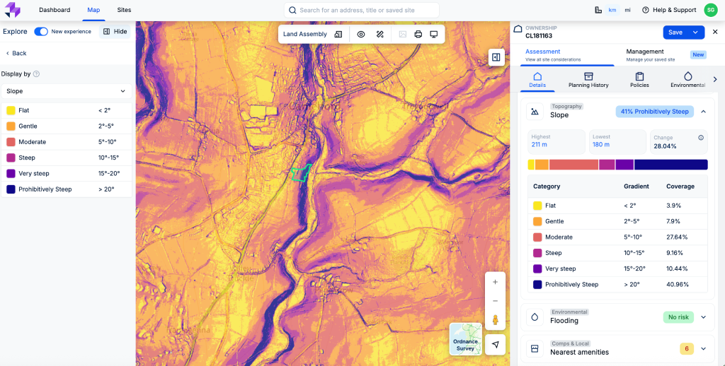
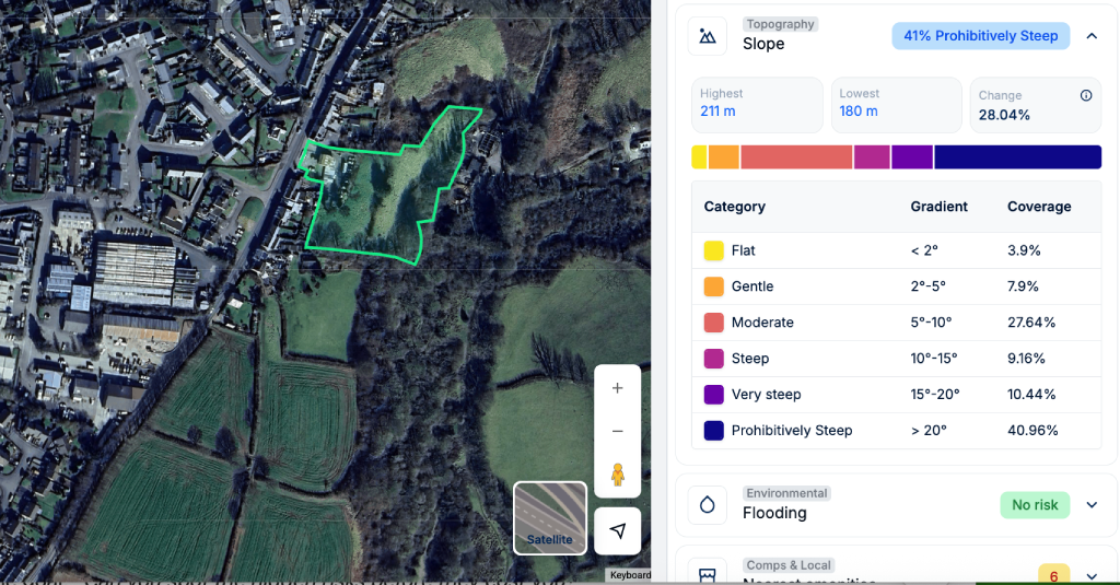
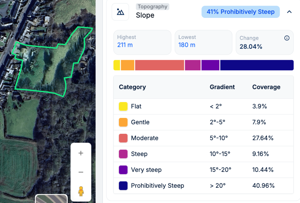
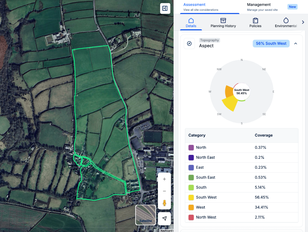
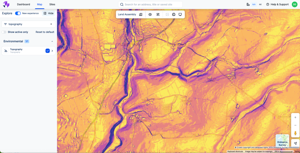
Avoid hidden site costs with enhanced terrain insight
Slopes, uneven terrain, and inaccessible land can turn a promising site into a very expensive mistake. Typically, you’d need to rely on costly surveys or external tools to check suitability, and it often comes late in the process.
Topography on LandInsight lets you eliminate unsuitable sites instantly by visualising slope, elevation and terrain at the very first stage of assessment. It saves time, reduces risk, and helps you focus only on land that’s buildable, accessible and cost-efficient.
Terrain insight you can act on
Slope visualisation
Quickly assess whether a site is too steep for development, and the direction of the slope
Elevation mapping
See height changes that impact design, access, and infrastructure
Full clarity over elevation, slope and aspect
Quickly identify risks so you can implement appropriate mitigation measures, or rule out sites that simply aren’t feasible
Move faster, earlier, and with confidence.
Identify suitable land instantly
Visualise slope, elevation and terrain in seconds before committing time or budget
Reduce costly errors
Avoid sites that will require extensive earthworks or inaccessible construction
Integrate with planning and constraints
Combine with other layers to make smarter decisions early in the development process
Know if your site is truly buildable
Try LandInsight and assess slope, elevation and terrain constraints instantly, so you can rule out unworkable sites early and avoid costly mistakes.
Request demo