


Land sourcing software that keeps your residential pipeline full
LandTech helps housebuilders and residential developers find off-market sites, see who owns them and check planning history and constraints. With Projects, you can then test a site's indicative capacity, run an appraisal and line up funding, without leaving the platform.
Trusted by residential developers across the UK
From first search to early scheme in one workspace
Site Sourcing
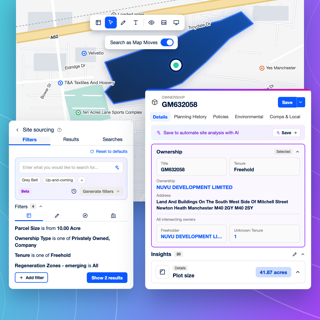
Find off-market sites that fit your schemes. Draw your target area and filter by site size, land use, planning status and constraints to see every site that matches, including underused land no agent has sent you. Save searches and work through results at the volume your pipeline needs.
Assess a Site
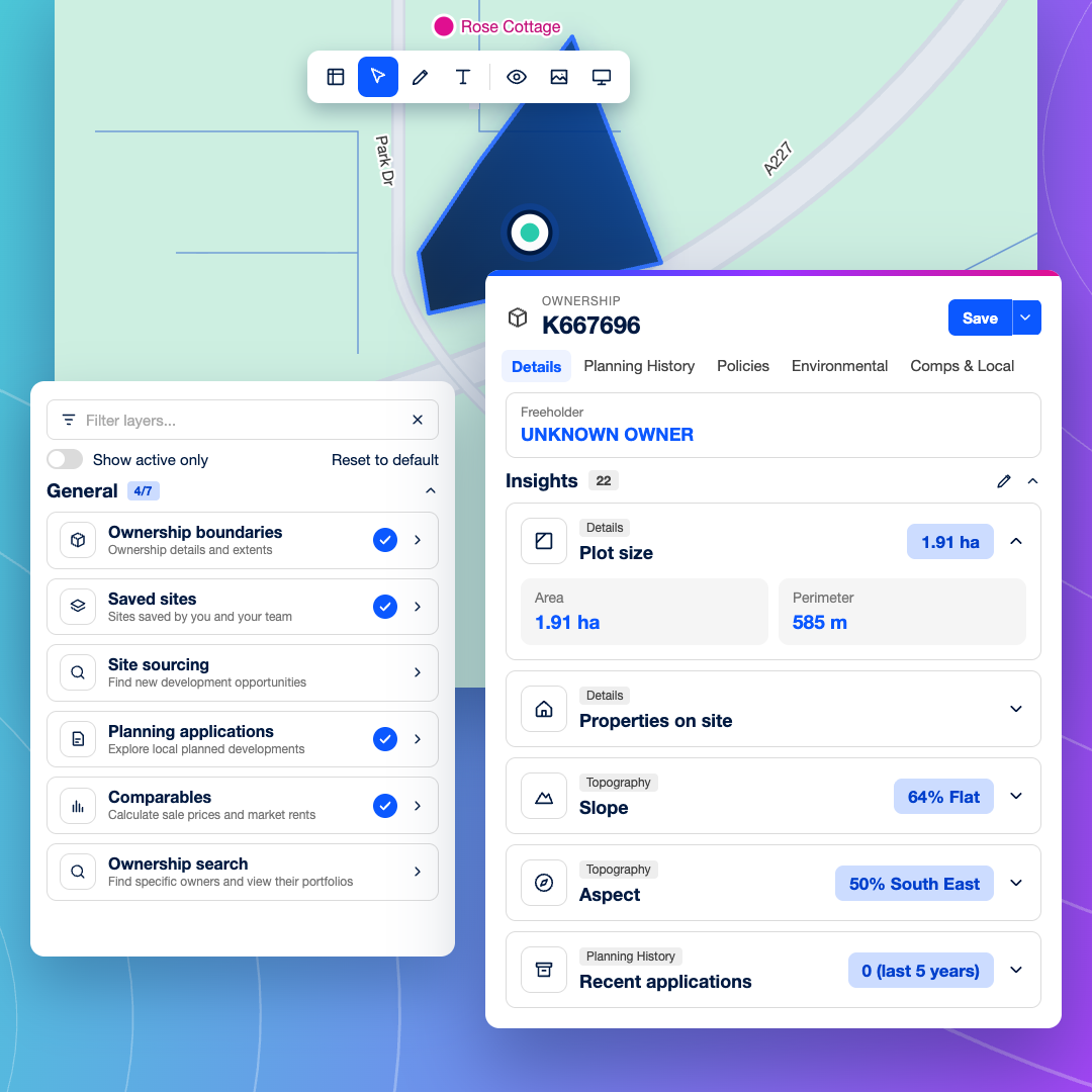
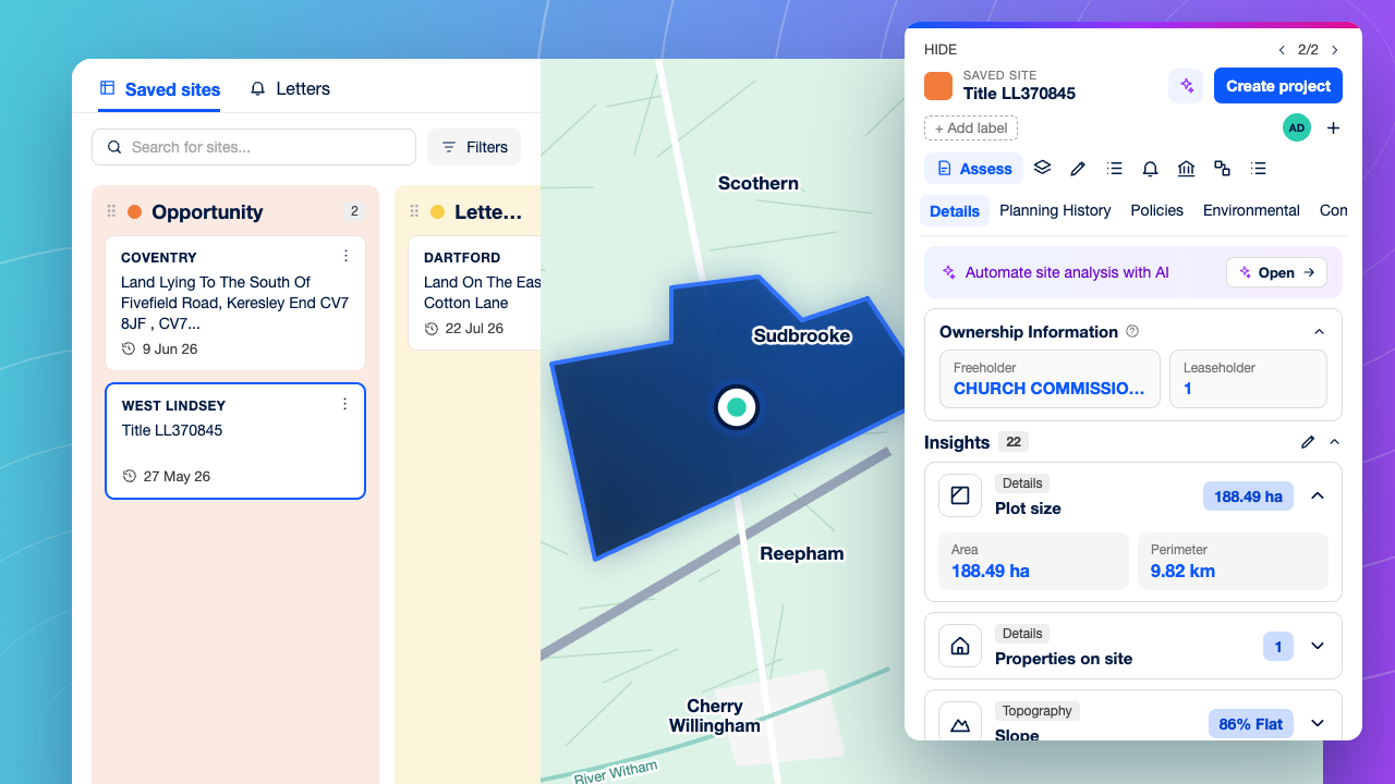
Qualify a site in one pass. See the registered owner, the site's planning history and nearby decisions, and the constraints and policy designations that apply, including Grey Belt favourability, all on one map. Spend your time only on sites with a credible planning route.
Site Reports
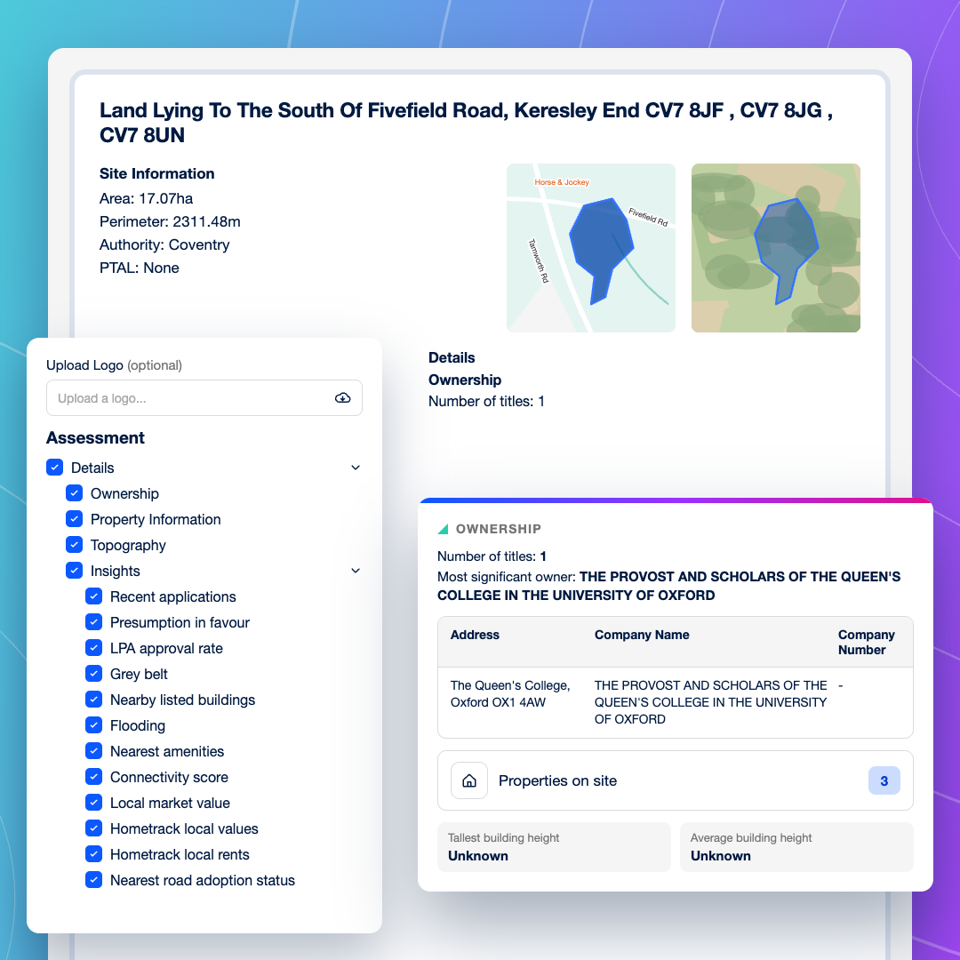
Take every site to committee on the same evidence. Turn any site into a consistent PDF covering ownership, planning history, constraints and local comparables, ready for your Land Director.
Scheme design
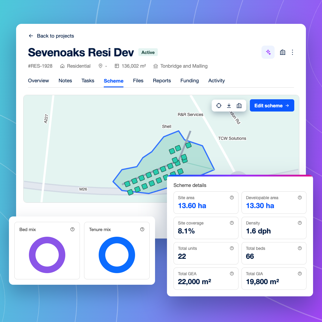
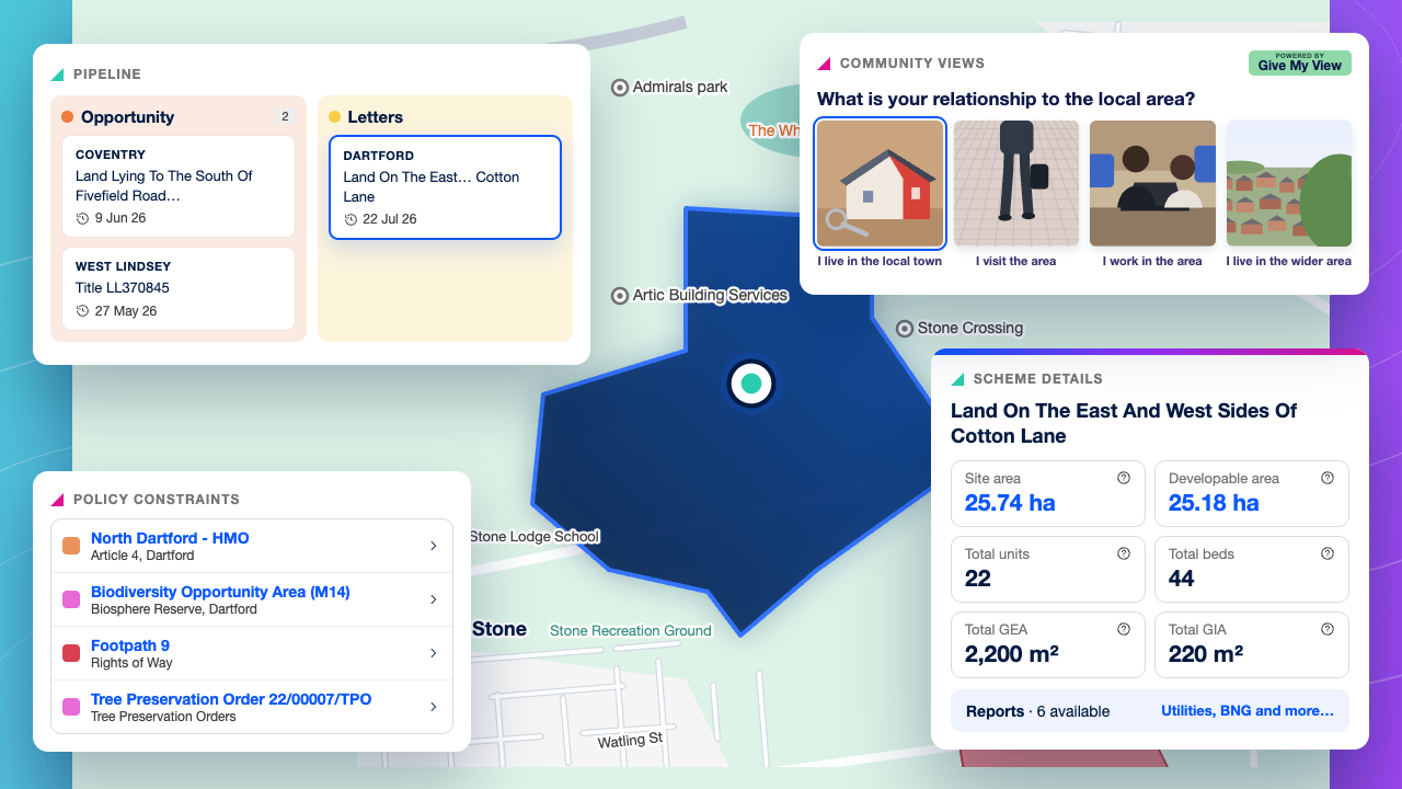
Find out how many homes a site could take before engaging an architect. In the Scheme tab, place units and draw access and exclusion areas, and the Scheme dashboard shows your developable area and indicative site capacity.
Funding
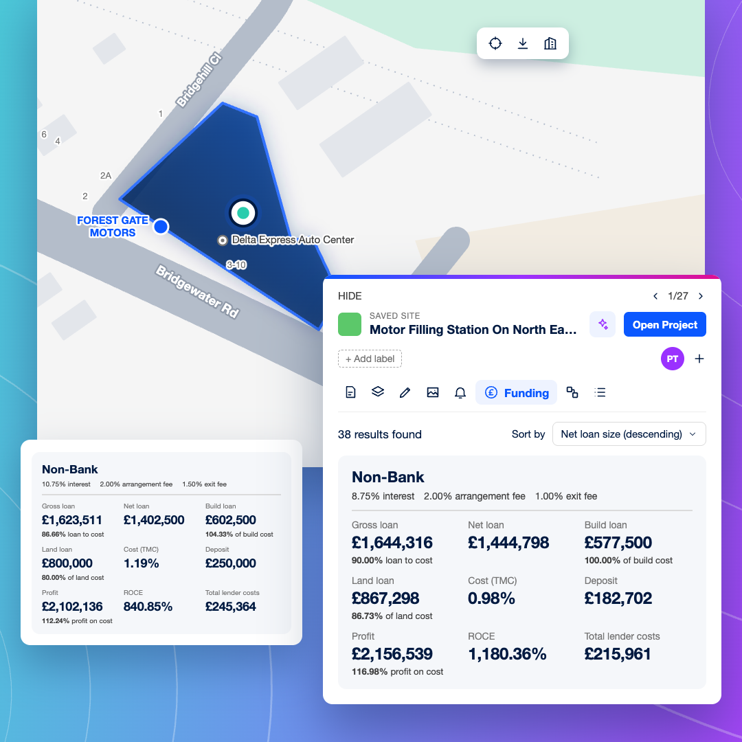
Line up development finance as the scheme moves forward. Explore funding through LandFund, supported by Brickflow, from the Project's Funding tab, with support from early site to final drawdown.
Appraisal
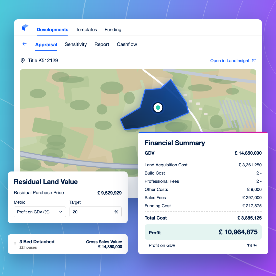
Know whether the numbers work before you commit. Run an appraisal from the Project using site data sent straight from LandTech, and test the numbers on day one.
Helping teams move faster, with confidence.
“We have found LandTech to be a fantastic platform. Not only has it improved the speed of initial site reviews, saving us time and ensuring we can move faster with landowners, but the constraints and opportunities insights they offer are now a fundamental part of our site-finding process.”
Mike Burton
Land Director, Metis Homes
Why teams switch to LandTech
Clear answers, not more data
LandTech is built around the checks land teams actually run: who owns the site, what has happened in planning and what stands in the way. Your team gets to a decision quickly, without wading through hundreds of filters first.
Policy layers that point to opportunity
Spot residential potential others miss, with Grey Belt favourability, station-led opportunities, new towns, Homes England sites and water neutrality mapped alongside your search.
Where other tools stop, Projects starts
Turn a viable site into a Project and keep working in one place. Test capacity with Scheme design, run an appraisal, explore funding through LandFund and share tasks and files across land, planning and finance as the scheme moves forward. There's no handover to spreadsheets, shared drives or generic project tools.
Built for every team that takes a site forward
Fill the pipeline, not just the inbox
Stop waiting on agent particulars. Search your target areas every week and build a pipeline of sites that match your criteria.
Qualify before you commit time
Check ownership, planning history and key constraints on first pass, so only sites with realistic routes go forward.
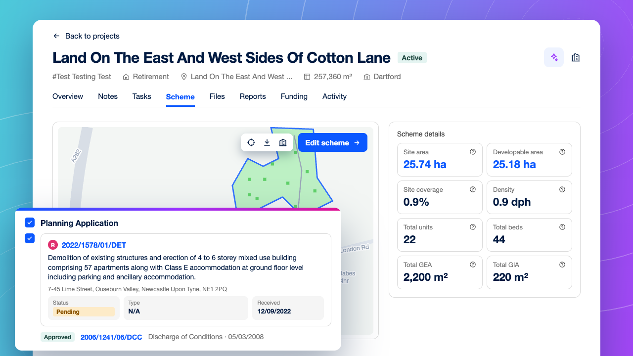
Take sites to committee with confidence
Present every opportunity with a standard site report, an indicative site capacity and an appraisal. Your Land Director can compare sites like for like and decide on what each one can deliver.
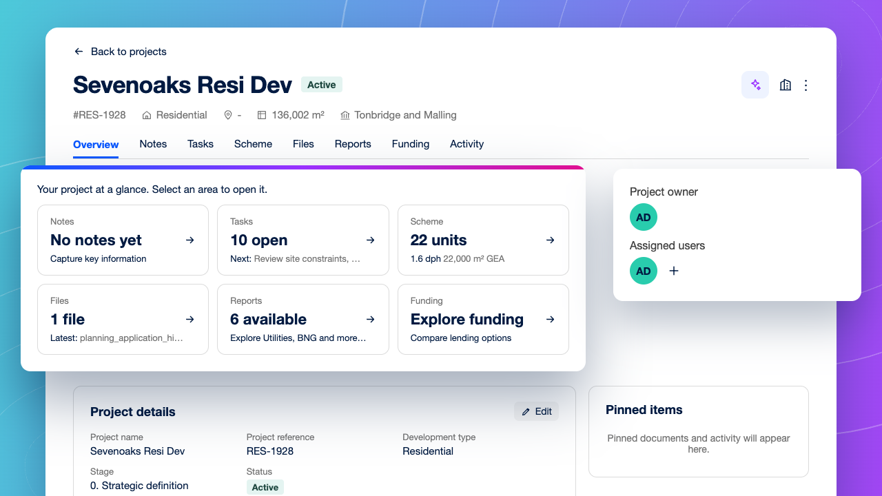
Pick up where land left off
When a site becomes a Project, its assessment, notes and files come with it. There’s no handover pack to rebuild, and nothing gets lost between acquisition and development.
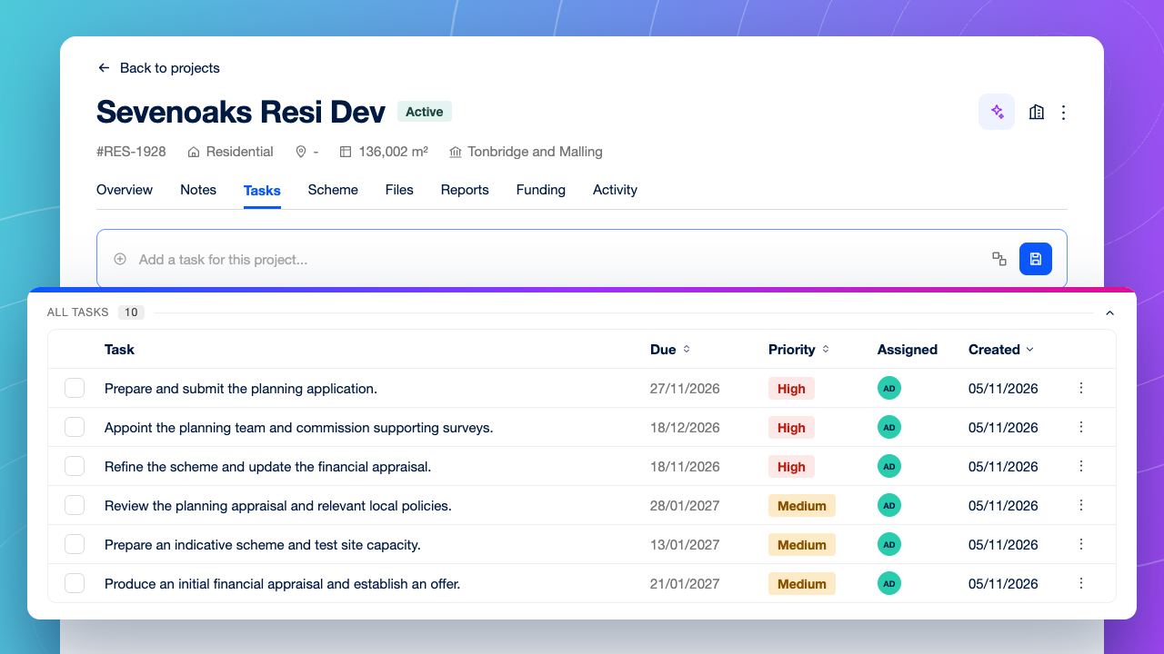
Keep every scheme moving
Assign tasks with owners, priorities and deadlines, or start from a residential template. Activity on each Project shows where every scheme stands without chasing updates.
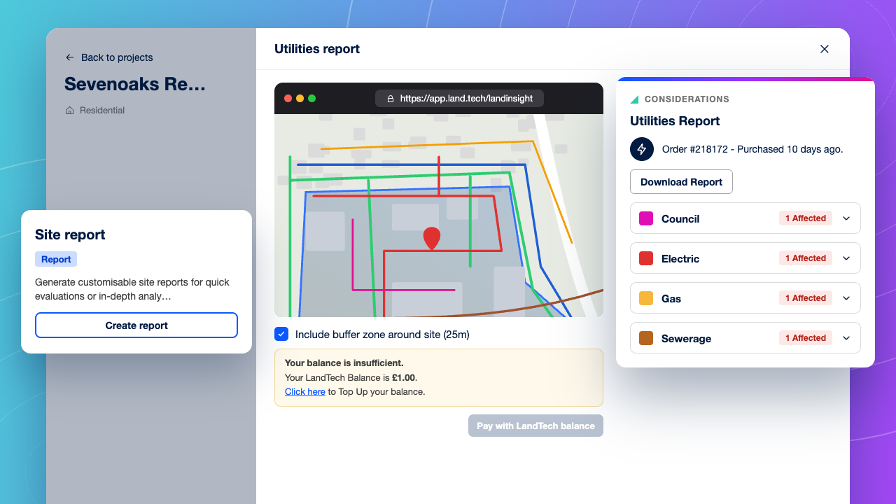
De-risk the site before pre-app
Commission surveys, utilities reports and early biodiversity assessments from the Project, so the technical evidence builds in one place as the scheme moves towards planning.
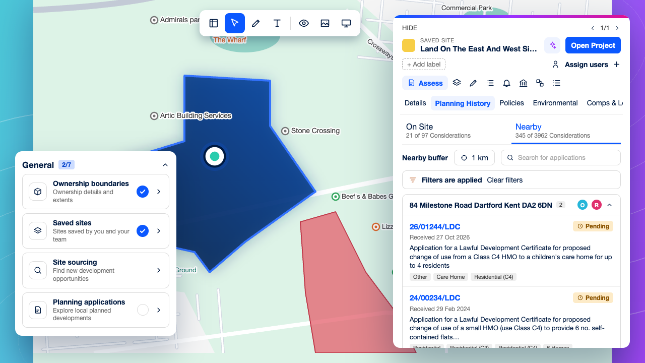
Read the local planning picture fast
See approvals, refusals and appeals around a site, so you can judge achievable density, mix and likely officer response.
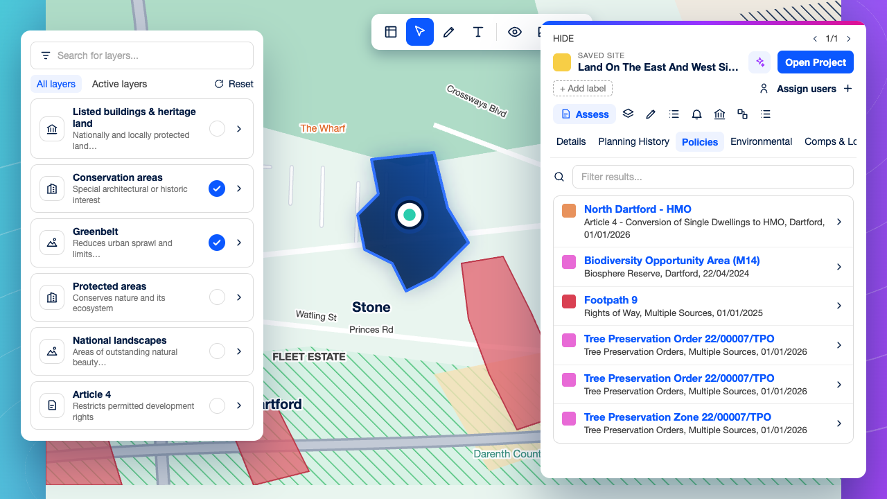
Every constraint in one view
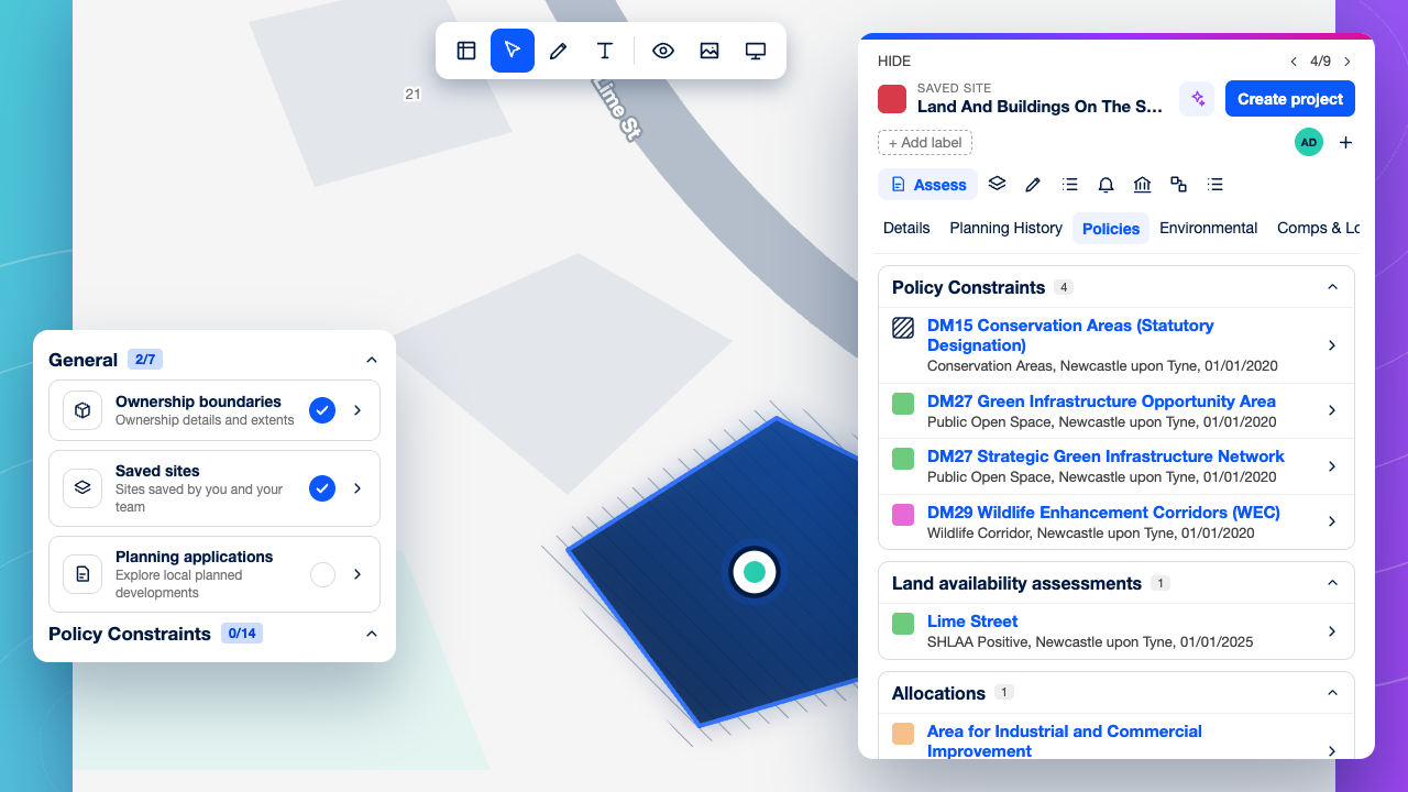
Layer Green Belt, flood zones, conservation areas and other designations over a site without leaving the map.
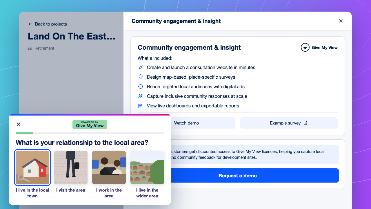
Build the evidence pre-application
Order utilities reports and early biodiversity assessments, and gather community feedback all from your Project. Everything stays in one place as the scheme moves towards planning.
Questions from Residential Developers
What should a residential developer look for in land sourcing software?
−
+
Look for four things: search tools that surface off-market sites, not just listed ones; ownership and planning data you can act on in a first-pass check; a consistent way to take sites to land committee; and somewhere to progress the sites you approve. LandTech covers all four, from sourcing and site reports through to Projects, where teams test indicative site capacity, run appraisals and commission surveys.
How is LandTech different from other land sourcing platforms?
−
+
Many land sourcing platforms focus on finding sites and filtering planning data. LandTech also covers what happens after a site is found. Viable sites become Projects, where your team can test indicative site capacity with Scheme design, run an appraisal, order technical reports, explore development finance and manage tasks. All of it stays connected to the original site assessment.
Do we still need an architect if we use Scheme design?
−
+
Yes, for the full scheme, but not to answer the first question. Scheme design is built for indicative capacity testing: you place units and draw access and exclusion areas, and the Scheme dashboard shows the developable area and indicative site capacity. Your team can see what a site could take before engaging an architect, and then brief them with a clearer starting point.
Can LandTech replace the spreadsheets and shared drives we use to manage our land pipeline?
−
+
Yes. Teams can share sites, create Projects, add notes and track each opportunity’s progress in one place, so land, planning and external consultants all work from the same information.
How reliable is LandTech’s ownership and planning data?
−
+
LandTech’s data is reliable because it comes straight from the official record and is kept current. Ownership is taken from HM Land Registry and Companies House, the legal sources of title and company information, and refreshed every month. Planning applications are collected directly from local planning authorities every 24 hours, so a decision shows up a day after it’s published. LandTech also publishes the source and update schedule for every dataset, so your team can see exactly where each piece of information comes from and how current it is before relying on it.
Can LandTech help fund a residential scheme?
−
+
Yes. From a Project's Funding tab, developers can explore development finance through LandFund, supported by Brickflow, with support from early site to drawdown. The appraisal and site data your team has already built sit alongside it in the same Project.
Ready to build a stronger pipeline?
See how LandTech helps residential land teams find more sites, qualify them faster and bring better-evidenced opportunities to land committee.
Enter search term