
Land sourcing software for energy developers

Find land for solar, wind, battery storage and data centres near the grid, see who owns every title, screen constraints and understand planning precedent, and build the community and environmental evidence your consent depends on, in one workspace.

From grid point to consent-ready site in one workspace

Grid-led site finding · 1 1 1080×1080@1x

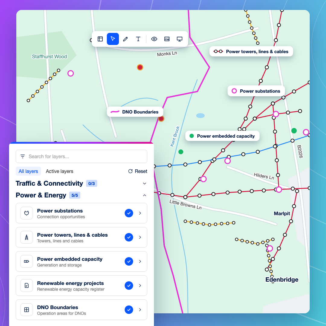
Grid-led site finding

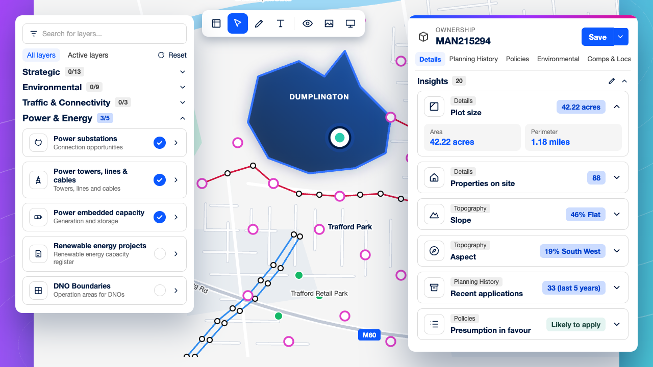
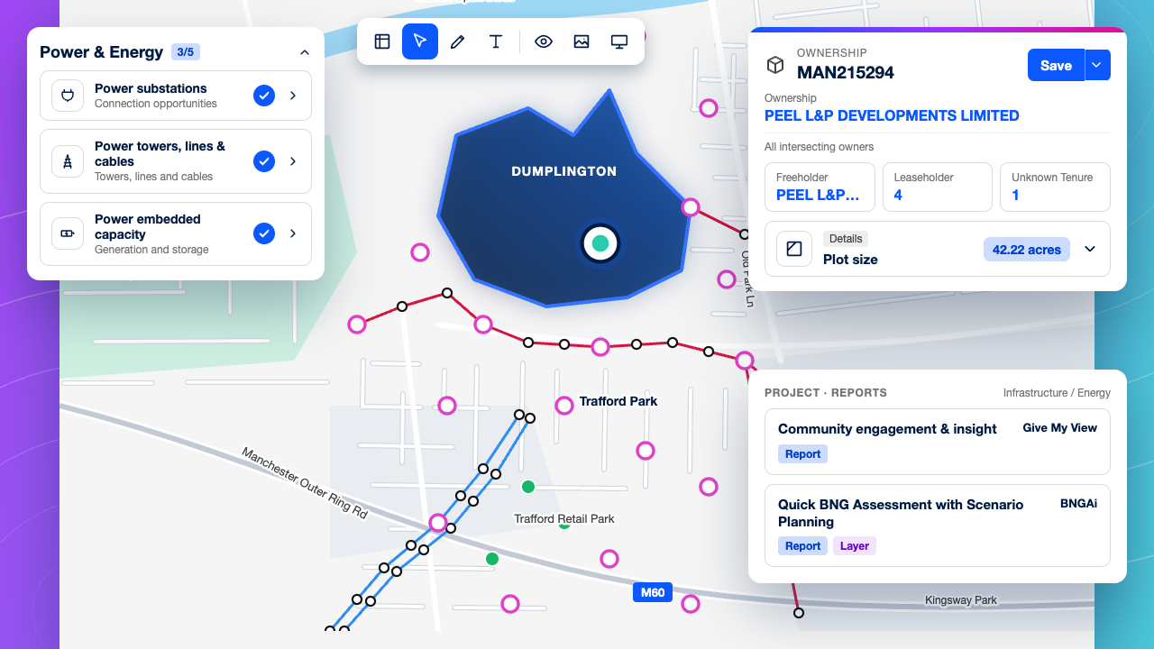
Filter for land within a set distance of a substation, then check power lines, existing generation and DNO boundaries on the map. Your origination effort starts where a connection is realistic.
Land assembly across fields · 1 1 1080×1080@1x

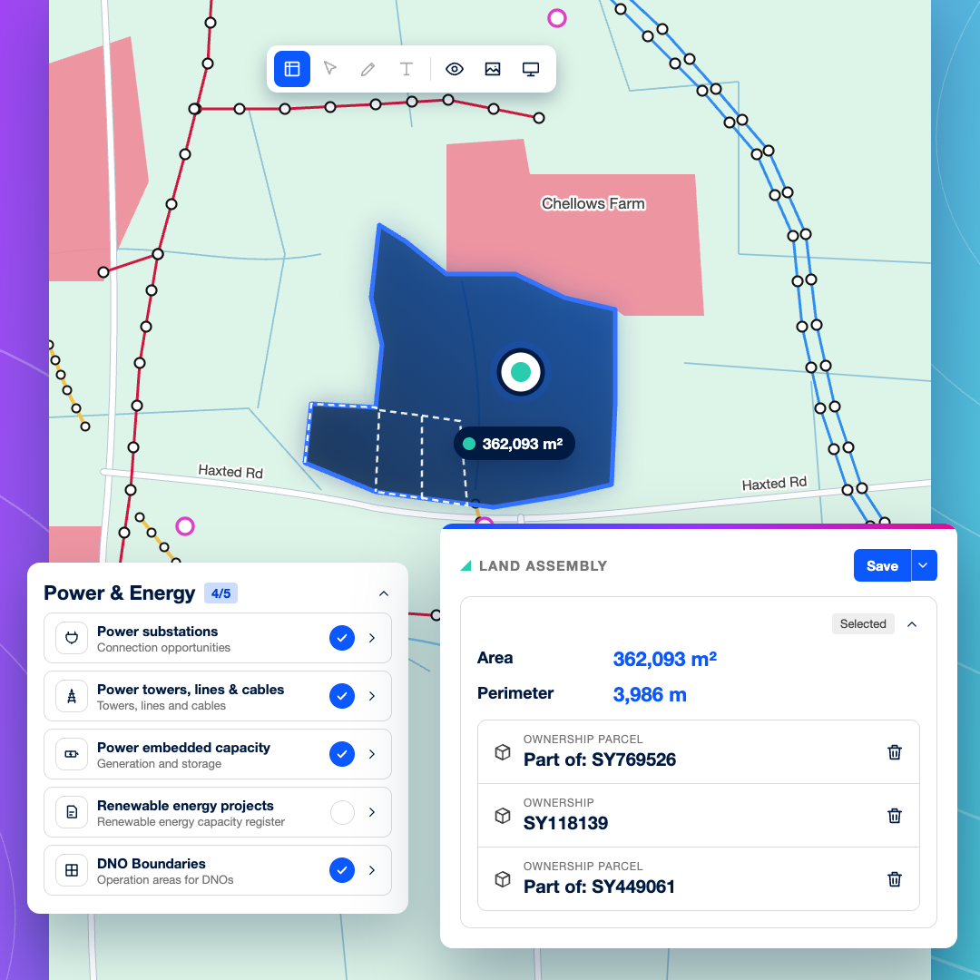
Land assembly across fields

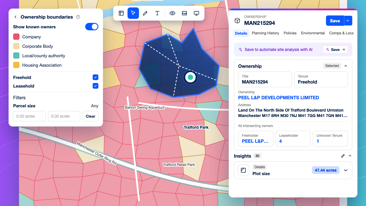
Draw a custom site boundary across neighbouring fields to assemble the site you need, and check the registered owner of each title it covers. You’ll know every landowner involved before you reach out.
Constraint screening · 1 1 1080×1080@1x

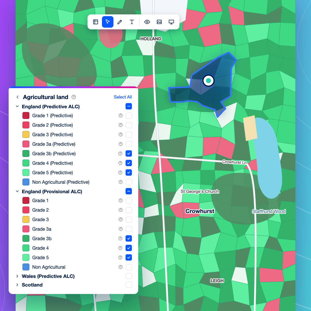
Constraint screening

Rule out sites early by checking agricultural land classification, protected landscapes, heritage designations, flood risk and Green Belt on one map, before anyone spends time on landowner talks.
Energy planning precedent · 1 1 1080×1080@1x

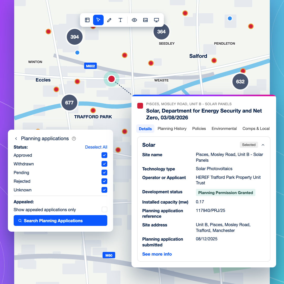
Energy planning precedent

See approvals, refusals and appeals nearby, and check the renewable energy projects register for schemes already planned or operating in the area. Planning data is updated every 24 hours.
Site reports and GIS export · 1 1 1080×1080@1x

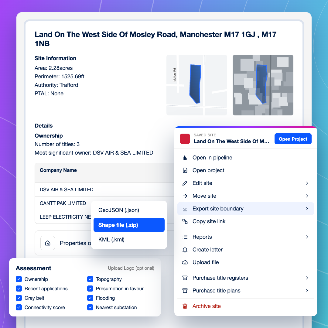
Site reports and GIS export

Produce a consistent site report for the investment committee, or export site boundaries as shapefiles to load into your GIS. Teams that need a live data feed can connect LandTech to their own systems through the API.
Consenting evidence · 1 1 1080×1080@1x

Consenting evidence

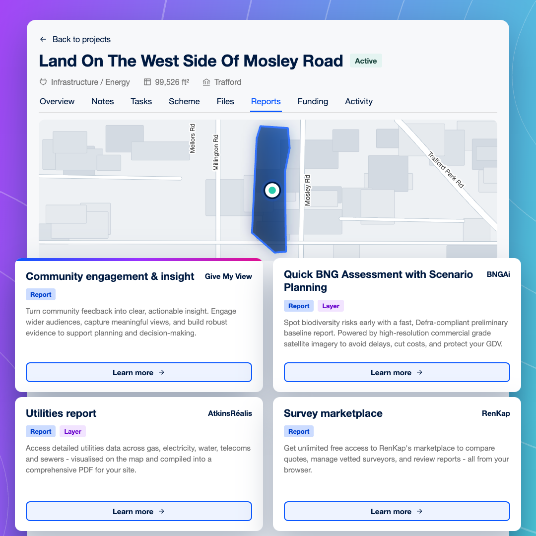
Turn a viable site into a Project to run community engagement, order an early biodiversity baseline and map utility networks, with tasks and files kept alongside the site.

Why origination teams switch to LandTech

Built for every team that takes an energy site forward

Start where the grid is · 16 9 1280×720@1x

Start where the grid is

Filter for land within a set distance of a substation that fits your site area, then check slope, aspect, existing generation and power lines on the map before you commit time.
Know every landowner involved · 16 9 1280×720@1x

Know every landowner involved

Draw your site boundary across neighbouring fields and check the registered owner of each title it covers, so you can approach every landowner involved with a scheme that works across their land.
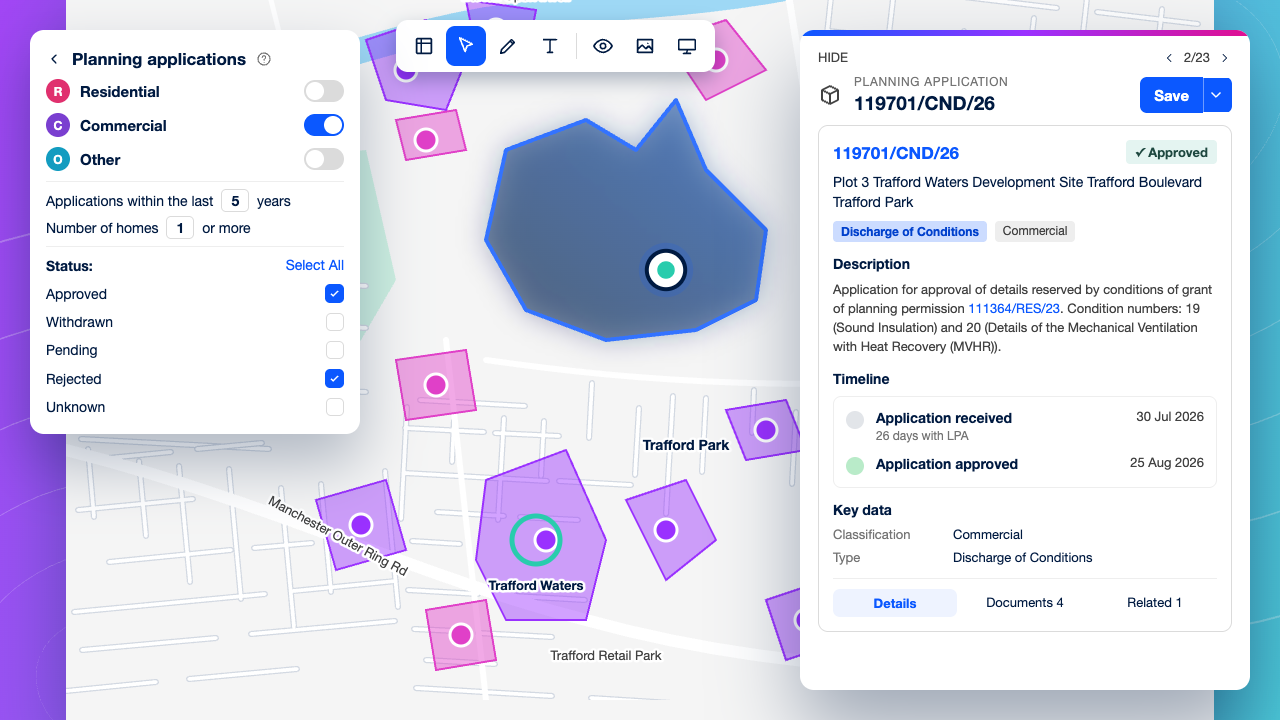
Drop unworkable sites fast · 16 9 1280×720@1x

Drop unworkable sites fast

Check constraints and nearby planning decisions on the first pass, so only sites with a credible consenting route reach landowner talks.
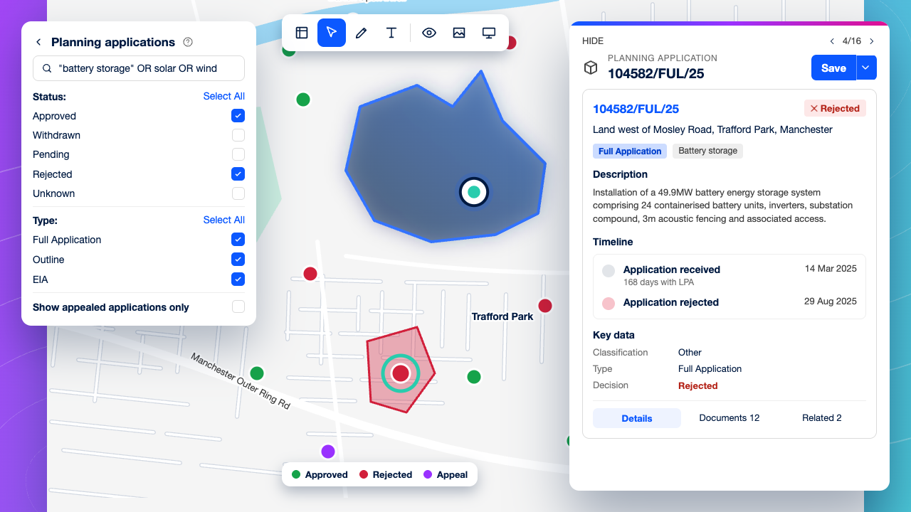
Understand what gets consented · 16 9 1280×720@1x

Understand what gets consented

Review solar, wind and battery storage decisions and appeals around a site to see which designs, sizes and mitigations local authorities have accepted.
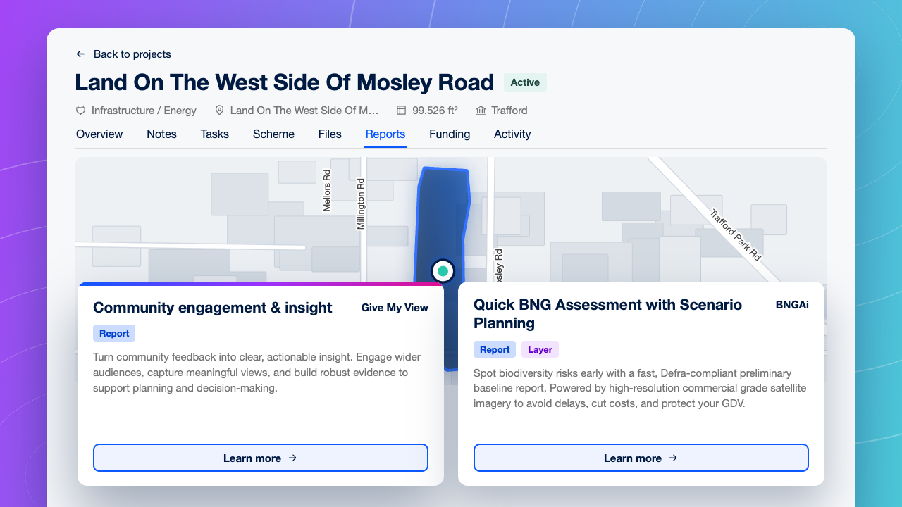
Build community and biodiversity evidence early · 16 9 1280×720@1x

Build community and biodiversity evidence early

Run community engagement and order an early biodiversity baseline from the Project, so the evidence builds alongside the scheme.
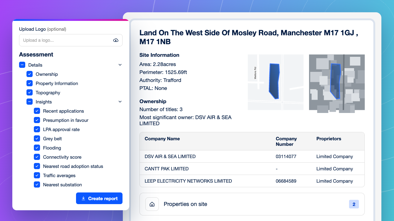
One set of evidence for investment committee · 16 9 1280×720@1x

One set of evidence for investment committee

Give every opportunity the same site report, so the committee compares sites like for like and decides faster.
Questions from Renewable Energy Developers

What should energy developers look for in land sourcing software?

−
Look for six things: search for viable sites close to the grid; constraint and policy screening, including agricultural land classification; tools for large sites, such as land assembly and custom site boundaries; planning and competitor intelligence; workflow and integration with your own systems; and a platform your team finds quick and easy to use. LandTech covers all six. It maps substations, power lines, existing generation and DNO boundaries alongside ownership and constraints, shows renewable energy projects planned or operating nearby, and supports community engagement, surveyor reports and biodiversity baselines in Projects.

Can LandTech find land near substations for solar and wind projects?

+
Yes. In Site Sourcing, you can filter for land within a set distance of a substation and combine that with site area, slope and aspect. The map also shows power lines and towers, existing embedded generation and DNO boundaries, so origination teams can focus on sites where a grid connection is realistic and know which network operator to approach.

How do energy developers identify landowners for large sites?

+
Large energy sites usually cross several titles, so developers need ownership for every parcel, not just one. LandTech shows title ownership for each field on the map, and you can draw a custom site boundary across neighbouring fields to assemble the site and check the registered owner of each title it covers. Teams can see every landowner involved before the first conversation.

Can LandTech screen sites for planning constraints before landowner engagement?

+
Yes. LandTech maps agricultural land classification alongside policy constraints including protected landscapes, heritage designations, flood risk and Green Belt, plus planning history for nearby solar and wind schemes. Teams can avoid the best and most versatile farmland and rule sites in or out before spending time with landowners.

Does LandTech show grid capacity?

+
LandTech shows the grid context around a site: substations, power lines, existing embedded generation and DNO boundaries. Together they show where the network is already busy and which operator covers the site. Available connection capacity has to be confirmed with the network operator, but LandTech helps teams decide which sites are worth that conversation.

Can LandTech data feed into our GIS tools?

+
Yes. Site boundaries can be exported as shapefiles and loaded into your GIS, and teams that need a live feed can connect LandTech data to their own systems through the API. LandTech handles sourcing and first-pass screening, and your GIS team keeps its own models.

How does LandTech support community engagement and biodiversity net gain for energy projects?

+
In LandTech Projects, developers can run community engagement through Give My View and order an early biodiversity baseline from BNGAi, alongside utility mapping, other surveyor reports and shared tasks. Consenting evidence builds in the same place as the site assessment.
Energy CTA · grid, landowners, consent evidence · 16 9 1280×720@1x

Ready to secure your next site first?

See how LandTech helps origination and development teams find land near the grid, identify every landowner and build the evidence for consent.

Book your demo now