


Land sourcing software for industrial and logistics developers
Find off-market commercial sites before they reach the market, see who owns every title, check B2 and B8 planning precedent, and assess access, power and constraints on one map.
Trusted by industrial and logistics developers across the UK
Every check a logistics site needs, in one workspace
Large-site sourcing
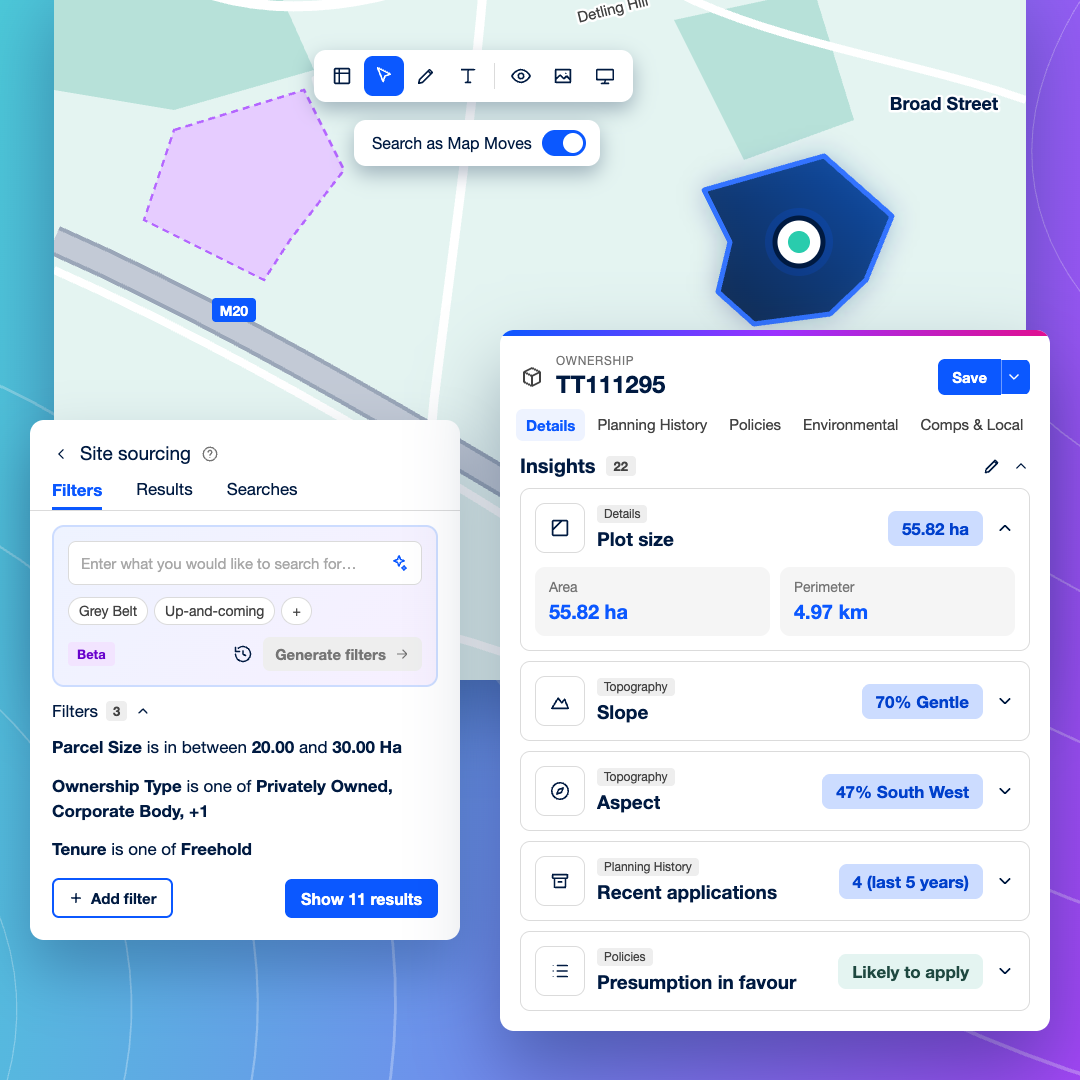
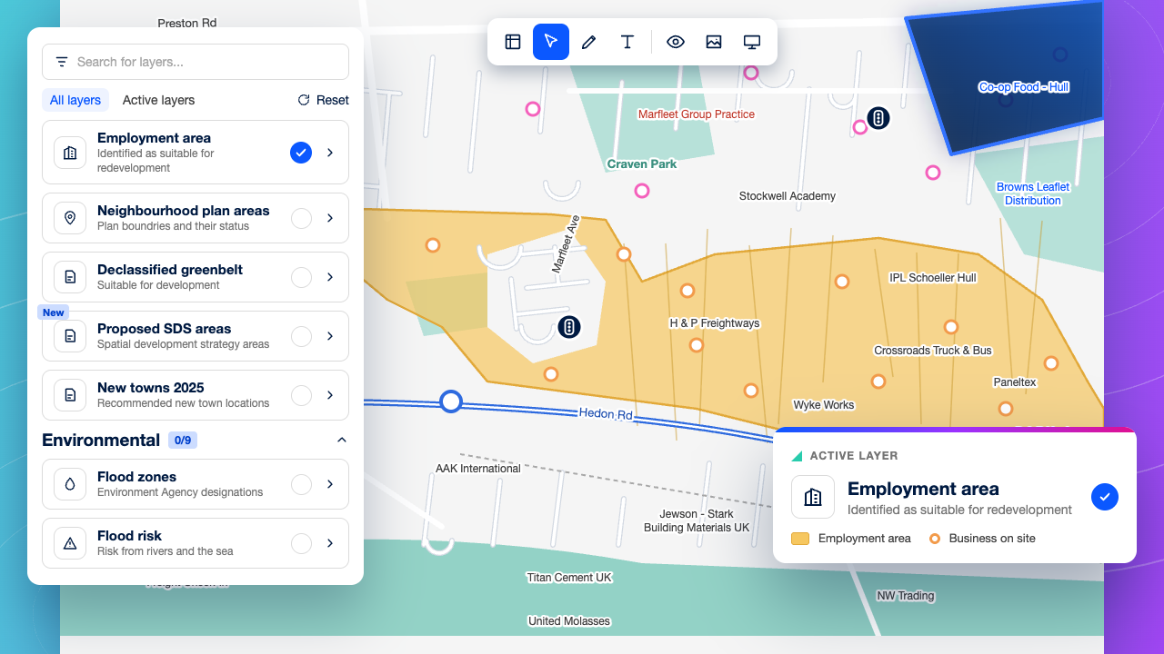
Search your target corridors by site area, use class and employment land allocations to find sites that fit your requirements, including off-market land and buildings no agent has brought to you.
Ownership and assembly
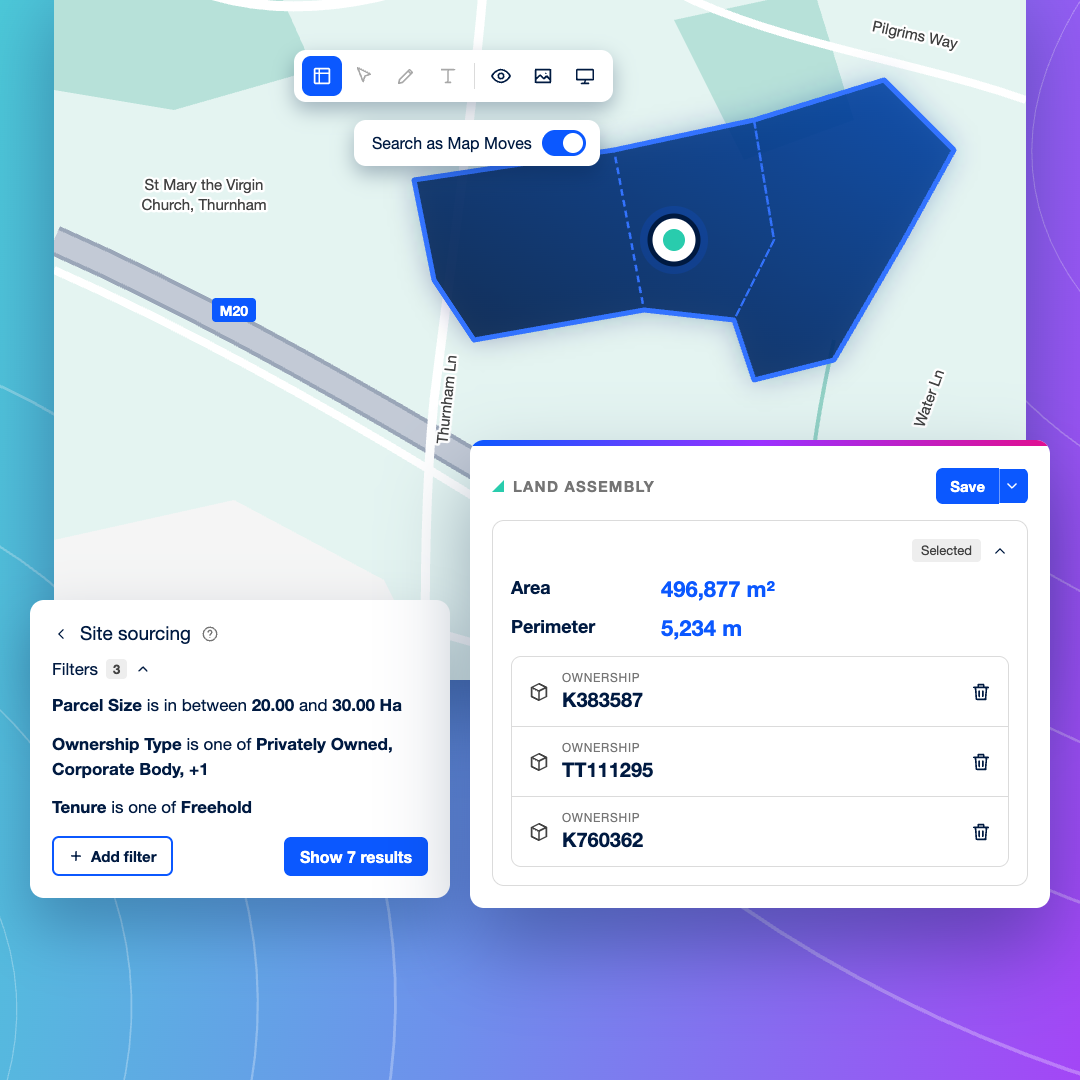
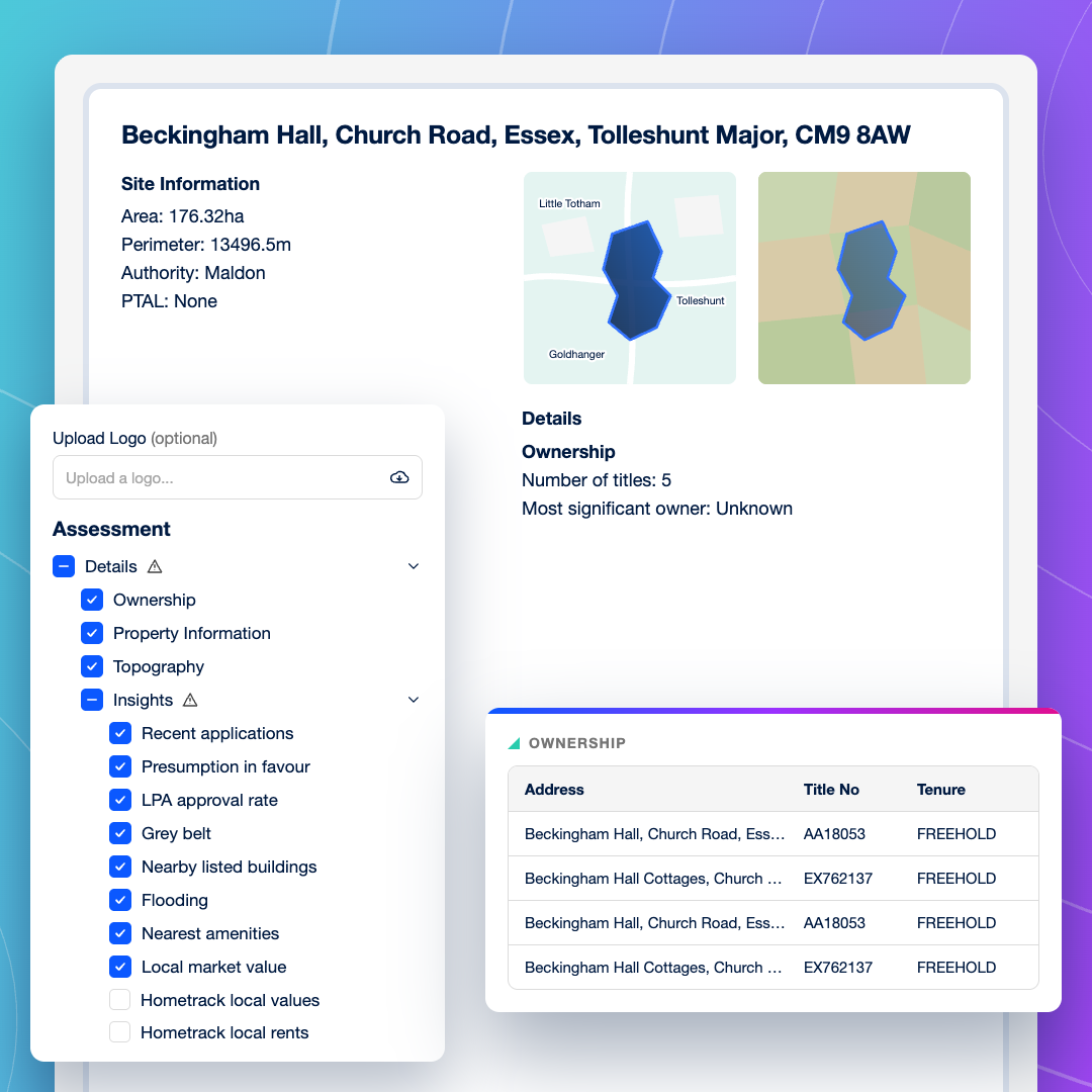
See who owns each title, and search by owner to find their wider holdings. Map every party you need to deal with before you make an approach to assemble a site.
Industrial planning precedent
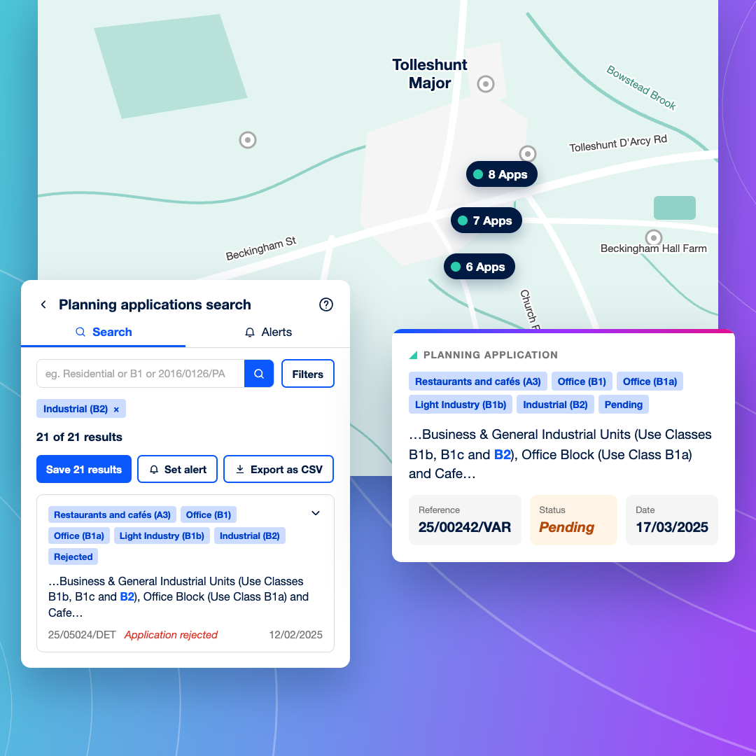
See approvals, refusals and appeals for B2 and B8 schemes nearby, and open the documents to check conditions on height, operating hours and HGV movements. Planning data is updated every 24 hours.
Site suitability
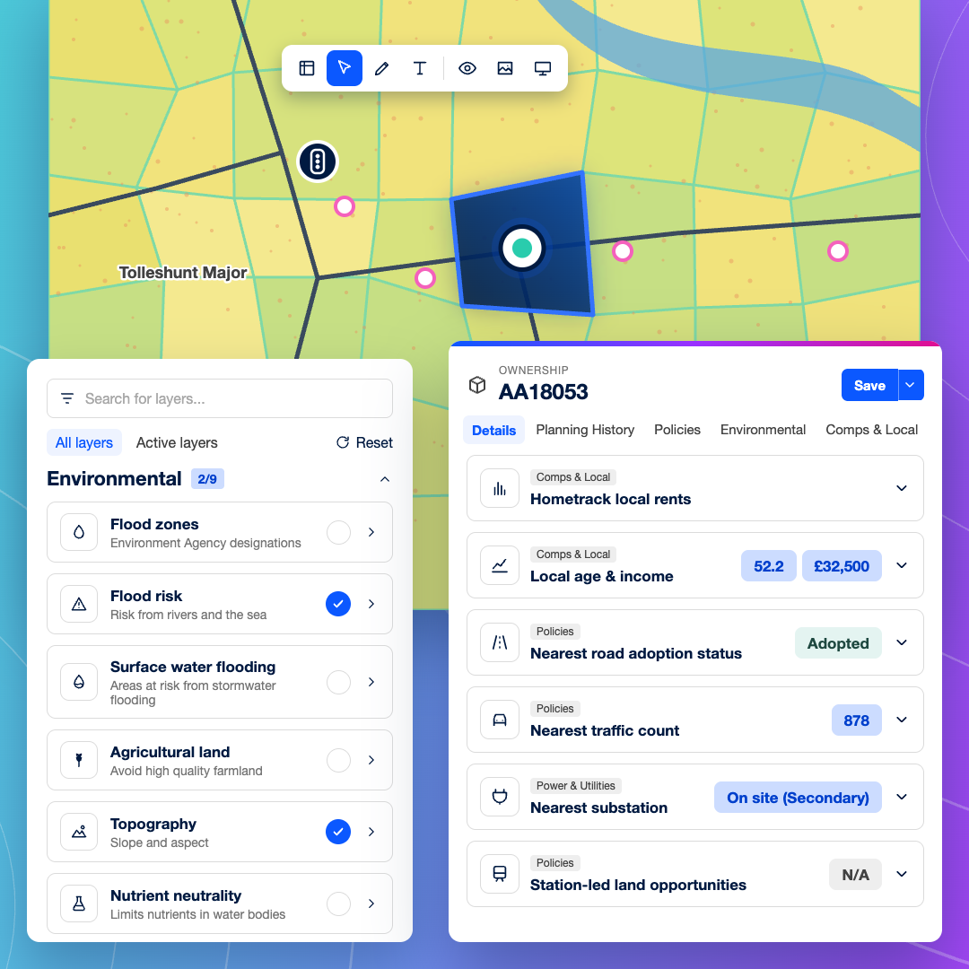
Check slope, flood risk, connectivity score, traffic counts and the nearest substation on the first pass, so you can rule sites in or out before spending time on them.
Site reports and data export
Produce a consistent site report for investment committee, or export your results to CSV for your own GIS tools and appraisal models.
Due diligence and funding
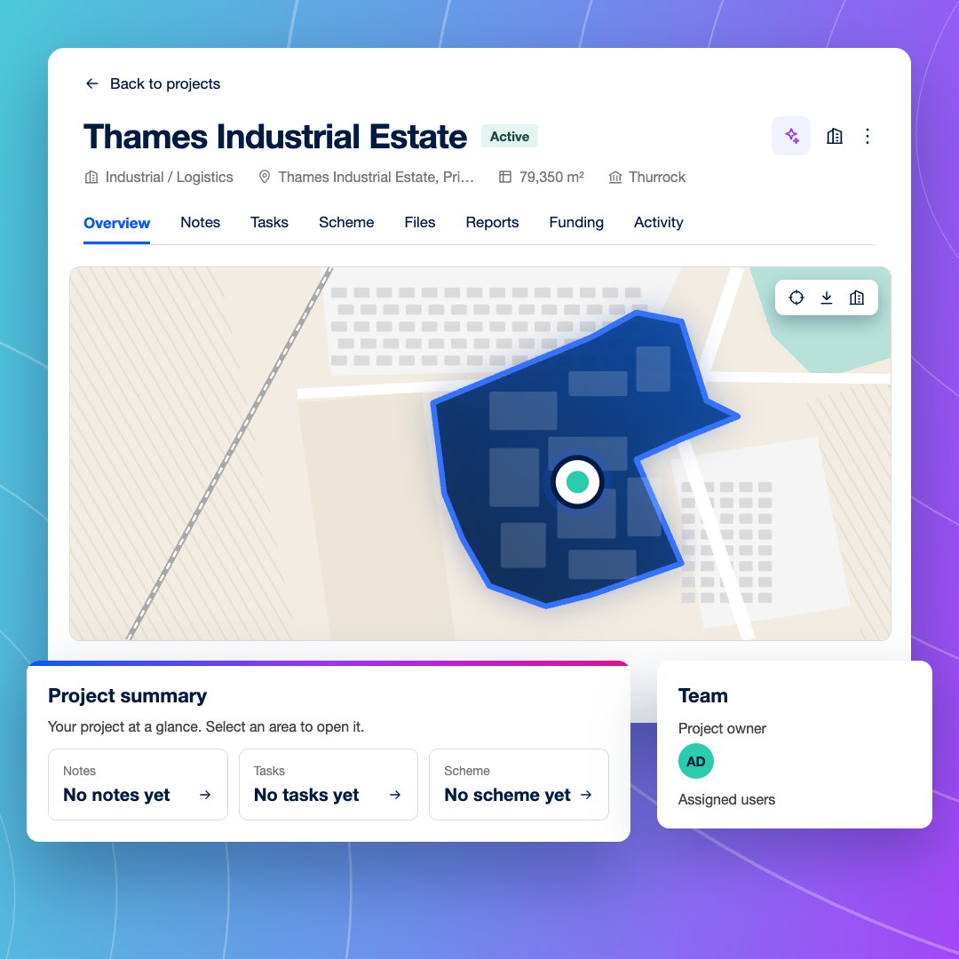
Turn a viable site into a Project to order utilities reports, surveys and early biodiversity assessments, and explore development finance through LandFund, supported by Brickflow.
Why acquisition teams switch to LandTech
Built for site assembly
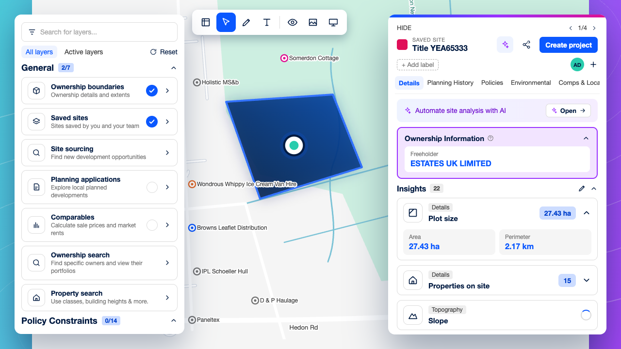
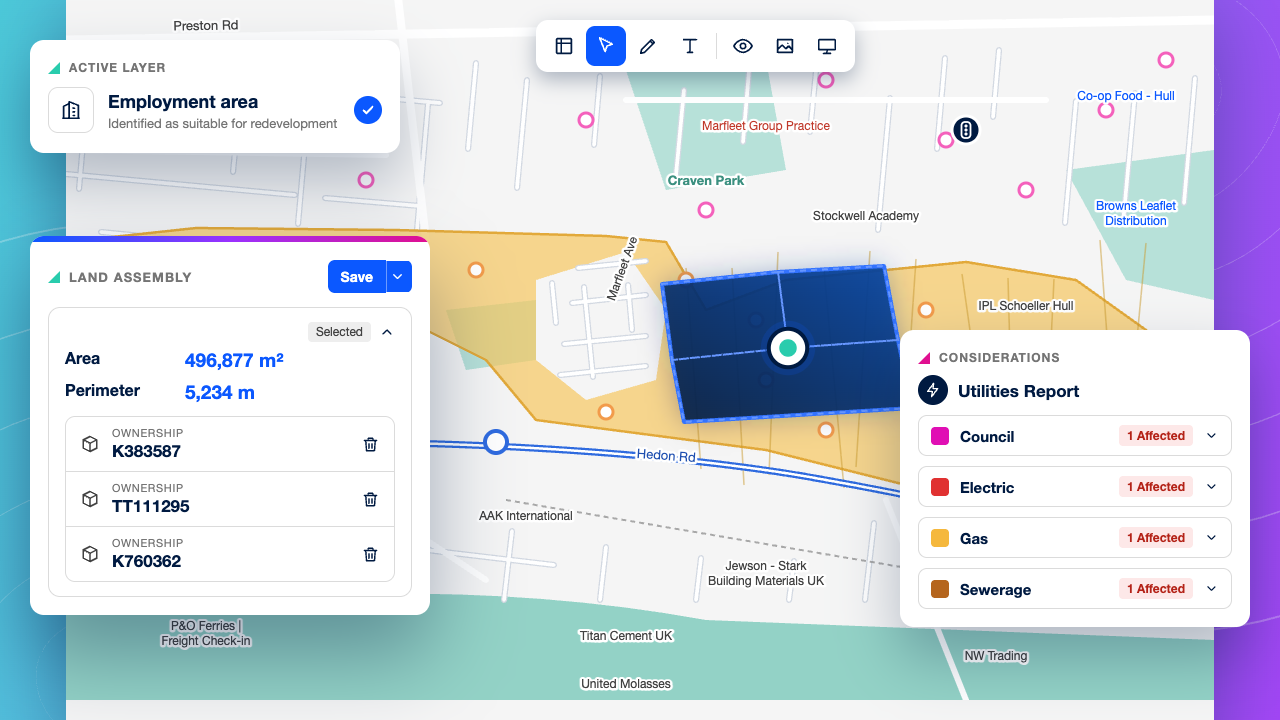
Assemble the site you need. Draw a custom boundary across neighbouring parcels, see the registered owner of each title inside it, and save the assembled site to your pipeline before you make an approach.
Planning precedent the day it’s decided
Planning applications are updated from local authorities every 24 hours, so a new B8 consent or refusal near your site shows up the next day, not the next week.
From shortlist to technical due diligence
Viable sites become Projects, where you can order utilities reports, surveys and biodiversity assessments and keep the evidence together. There’s no handover to spreadsheets or shared drives.
Built for every team that takes an employment site forward
Find sites before they’re marketed
Search your target corridors for employment land and buildings that meet your site area and use class criteria, then approach the owners before agents do.
Assemble the site with confidence
Draw the site you need across several titles and see who owns each one, so you know every party involved before you make an approach.
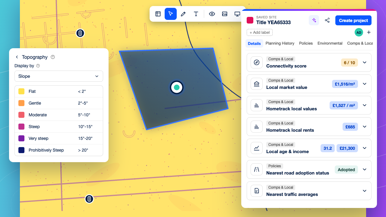
Rule sites in or out early
Check slope, flood risk, road connectivity and nearby industrial decisions on the first pass, so only sites that work for logistics go forward.
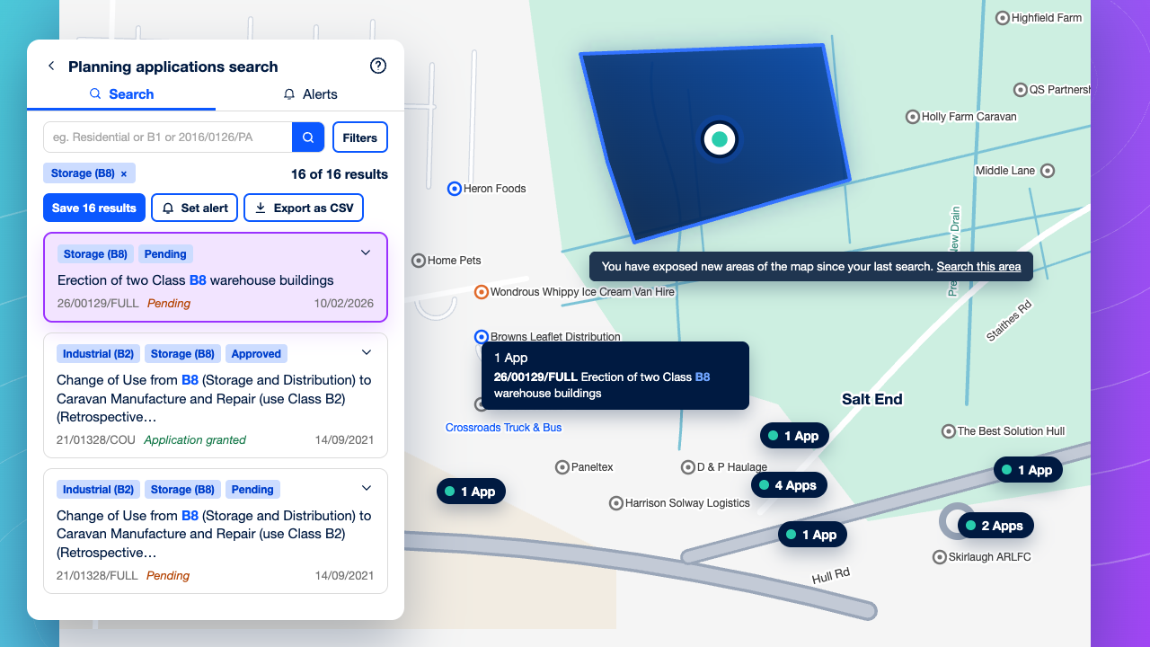
Know the planning context
Review B2 and B8 consents, refusals and appeals around a site, and check the conditions that shape what you can build and how it can operate.
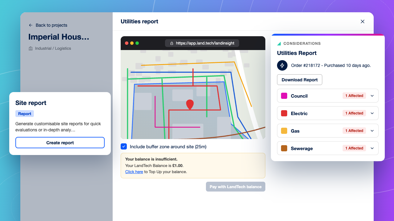
Find utility issues before you commit
Order a utilities report from the Project to map electricity, gas, water and telecoms networks across the site, so connection questions come up early.
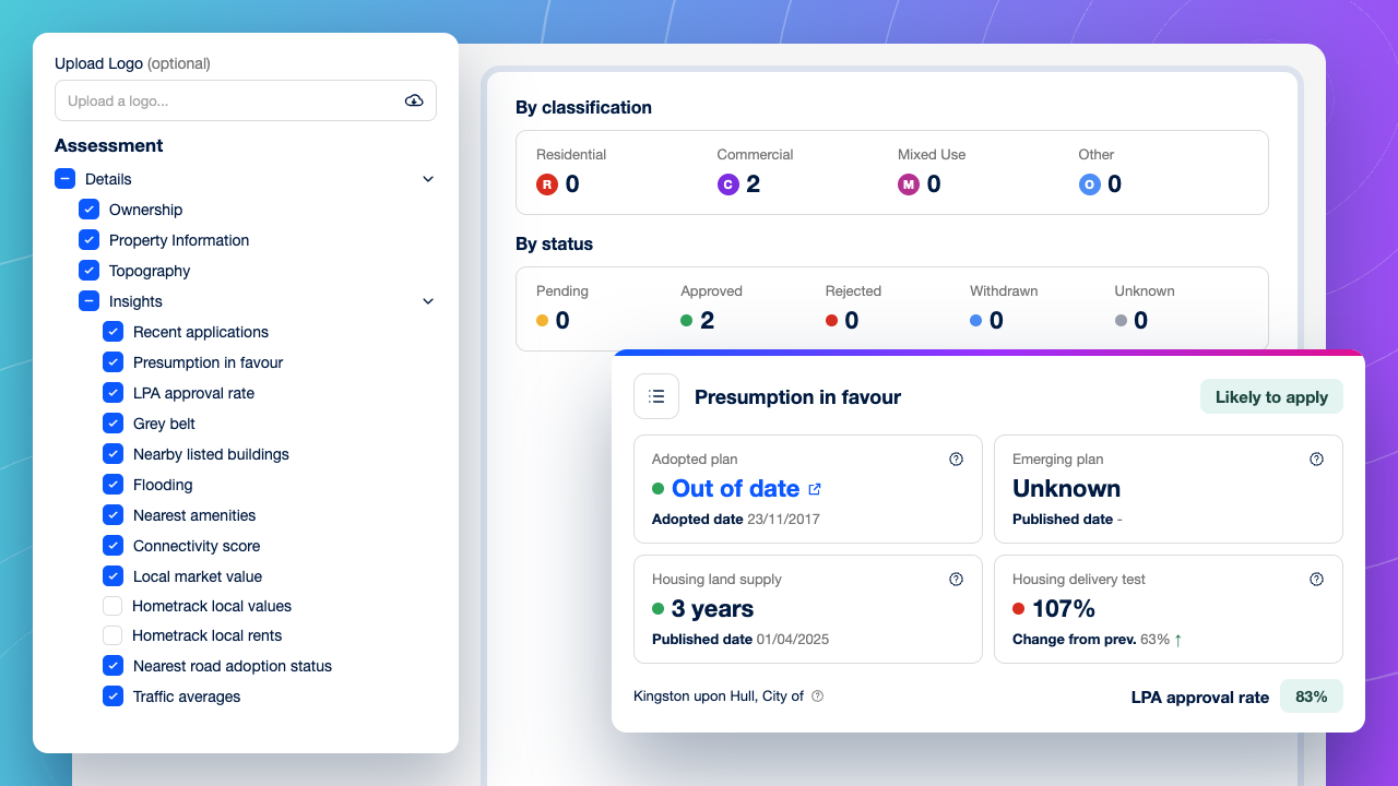
One set of evidence for investment committee
Give every opportunity the same site report, or export the data into your own models, so committee compares sites like for like.
Questions from Commercial Developers
What should logistics and industrial developers look for in land sourcing software?
−
+
Look for five things: large-site search by area, use class and employment land allocations; transport and connectivity; B2 and B8 planning precedent; quick checks on access, power and flood risk; and a way to export data into your own models. LandTech covers all five, and viable sites can move into Projects for technical due diligence.
How can I find land allocated for employment use?
−
+
Employment land allocations are set out in each council’s local plan. LandTech maps these allocations alongside ownership and planning data, so you can filter for allocated employment sites in your target areas and see who owns them, all in one search.
How does LandTech help assemble a logistics site with multiple owners?
−
+
LandTech shows title ownership on the map for every parcel in a site. Ownership Search finds other land held by the same owner. Together they let your team see every party involved, and spot owners with wider holdings, before planning an approach.
Can LandTech assess access, power and flood risk for an industrial site?
−
+
Yes. LandTech’s site assessment shows slope, flood risk, connectivity score, and the nearest substation for any site across the UK, though traffic points are England only. For more detail, a utilities report ordered from a Project maps the electricity, gas, water and telecoms networks across the site.
How current is LandTech’s planning data for industrial and logistics schemes?
−
+
Planning applications are collected from local planning authorities every 24 hours, and appeals from the Planning Inspectorate every three months. Every dataset’s source and update schedule is published, so your team knows exactly how current the information is.
Can LandTech data feed into our GIS and appraisal models?
−
+
Yes. Export search results to CSV, export site boundaries as shapefiles to load into your GIS, or connect LandTech data to your own systems through the API.
How is LandTech different from other land sourcing platforms for commercial developers?
−
+
See how LandTech helps acquisitions teams find off-market commercial sites, assemble them with confidence and rule out showstoppers early.
Ready to find your next logistics site first?
See how LandTech helps acquisitions teams find off-market employment sites, assemble them with confidence and rule out showstoppers early.
Enter search term