
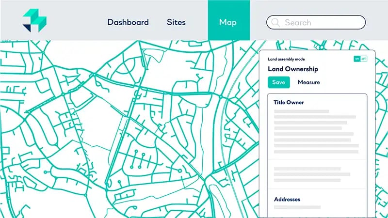
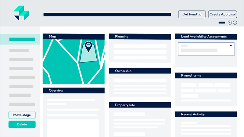
Ownership data
What does LandTech’s Ownership data provide?
Our Ownership data allows property professionals to view the ownership and contact information for any site whose owner is in the public domain. Sites owned by companies, corporate bodies, local authorities, housing associations, etc can easily be identified as such.
What Ownership datasets are available, where do they come from, and how often are they updated?
Ownership data
| Dataset | Source | Updated |
|---|---|---|
| Parcels | HM Land Registry | Every month |
| Ownership information | HM Land Registry and Companies House | Every month |
| Addresses | OS AddressBase Plus | Every 4-6 weeks |
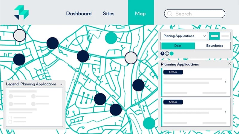
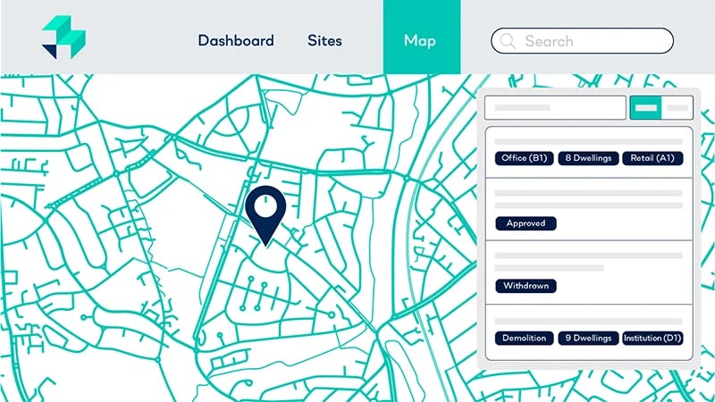
Planning Applications data
What does LandTech’s Planning Application data provide?
LandTech’s Planning Application data allows users to see the most up to date information for ongoing and also historical planning applications, covering residential, commercial and also other applications.
Users can also see where planning applications have been approved, rejected and also appealed.
What Planning Applications datasets are available, where do they come from, and how often are they updated?
Planning Applications data
| Dataset | Source | Updated |
|---|---|---|
| Planning application information, including planning application details and boundaries (where possible) | Local planning authorities (LPAs) | Every 24 hours |
| Planning appeals | Planning Inspectorate Appeals Database | Every 3 months |
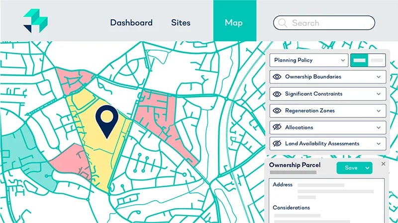
Planning Policy data
What does LandTech’s Planning Policy data provide?
Our Planning Policy data is available for England and Wales and includes a plethora of information to better understand opportunities in your chosen area.
What Planning Policy datasets are available, where do they come from, and how often are they updated?
Significant Constraints data
| Dataset | Source | Coverage | Updated |
|---|---|---|---|
| Flood zone | Environment Agency Flood Zones 2 and 3 | England and Wales |
Updated as soon as updates are made available |
| Flood risk | Environment Agency Risk of Flooding from Rivers and the Sea / NRW / SEPA | Great Britain |
Updated as soon as updates are made available |
Heritage Land/Listed buildings |
Historic England / Historic Environment Scotland / Cadw |
Great Britain |
Monthly |
Conservation areas |
Historic England / Cadw / Historic Environment Scotland / Local Authorities |
Great Britain |
Updated annually |
Protected area. Covering:
|
Natural England / SEPA / NRW / Scottish Government / Local Authorities |
Great Britain |
Updated as soon as updates are made available |
Settlement boundaries and other policy designations |
From Adopted Local Plan for each local authority, and Emerging Local Plan (if available) |
Great Britain |
Updated as soon as updates are made available. Dependant on publication of local plan documents. |
Green Belt |
Ministry of Housing, Communities and Local Government (MHCLG) / Local Authorities / Scottish Government |
Great Britain |
Annually |
Nutrient Neutrality |
Natural England, Natural Resources Wales, Local Planning Authorities |
England and Wales |
Updated as soon as updates are made available |
Water Neutrality |
Environment Agency, Natural England, Local Authorities |
England |
Updated as soon as updates are made available |
Rights of way |
Local Planning Authorities and other public sources |
England and Wales |
Updated as soon as updates are made available |
Metropolitan Open Land/Open Space |
London Datastore, Local Planning Authorities |
England |
Updated as soon as updates are made available |
Tree Preservation Orders |
HMLR, planning.data.gov.uk, Local Planning Authorities, LT planning database |
England and Wales |
As new councils join the HMLR LLC programme |
Regeneration Zones data
| Dataset | Source | Updated |
|---|---|---|
Area Action Plans |
Local plans, both adopted and emerging |
Updated when new emerging plans are published, or when emerging plans are adopted |
Named Regeneration Areas |
Local plans, both adopted and emerging |
Updated when new emerging plans are published, or when emerging plans are adopted |
Allocations data
| Dataset | Source | Updated |
|---|---|---|
Residential Allocations |
Local plans, both adopted and emerging |
Updated when new emerging plans are published, or when emerging plans are adopted |
Site Allocations |
Local plans, both adopted and emerging |
Updated when new emerging plans are published, or when emerging plans are adopted |
Land Availability Assessments data
| Dataset | Source | Updated |
|---|---|---|
SHLAA |
Local authorities |
Updated as soon as we’re notified a new SHLAA/HELAA/SHELAA document has been published. |
Brownfield Register - Point data |
planning.data.gov.uk (sourced and collated from individual local authorities, cleaned by LandTech) |
Updated annually |
Agricultural Land Classification data
| Dataset | Source | Updated |
|---|---|---|
Best and most versatile agricultural land classification (BMV) |
Natural England and Natural Resources Wales |
Annually |
Local Planning Authority data
| Dataset | Source | Updated |
|---|---|---|
Local planning authority boundaries |
Local planning authorities |
Annually |
Local plan status (i.e. In/out of date) |
Planning Inspectorate record of plans containing Strategic Policies |
As soon as we’re notified of an update |
Housing delivery test status (I.e. has the authority achieved 75% of its need, or government housing targets) |
Department of Levelling Up Housing and Communities annual report |
Annually, or as published. |
Housing land supply status (I.e.Is the council able to demonstrate 5 years worth of housing land supply?) |
Various public sources, including the local authority updates and planning appeals. |
We’re constantly tracking this and we update our dataset monthly. |
Emerging plan status |
Planning Inspectorate record of plans containing Strategic Policies |
As soon as we’re notified of an update |
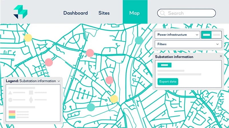
Power Infrastructure data
What does LandTech’s Power Infrastructure data provide?
The LandTech Power Infrastructure data provides property professionals with two main sources of information. The first provides details of distributed network operator (DNO) substations, and allows capacity to be analysed so that sites can be sourced in the right locations with power supply in mind.
The second provides details of the locations of National Grid towers, power loans and cables.
What power infrastructure datasets are available, where do they come from, and how often are they updated?
Power infrastructure data
| Dataset | Source | Updated |
|---|---|---|
Substation information |
Electricity North West, Northern Powergrid, SP Energy Networks, UK Power Networks, SSE, Western Power Distribution (now part of National Grid) |
Daily |
Towers & Cables |
UK Power Network |
Updated every quarter |
Property Information data
What does LandTech’s Property Information data provide?
With a single click, users will be able to enquire on the use class, building dimensions, constraints, flood areas (and more) of a site.
What Property Information datasets are available, where do they come from, and how often are they updated?
Property Information data
| Dataset | Source | Updated |
|---|---|---|
Use Class, type of property and status |
OS AddressBase Plus |
Every 4-6 weeks |
Building dimensions |
OS Master Map |
N/A |
Listed buildings |
Historic England / Historic Environment Scotland / Cadw |
Monthly |
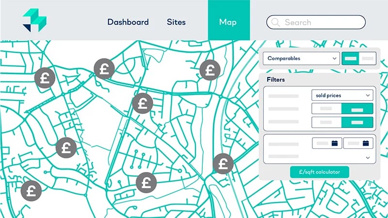
Comparables data
What does LandTech’s Comparables data provide?
View the latest sold prices for residential and commercial properties in your areas of interest, and then use that data to calculate what the potential sold price of your development could be.
Users can also take advantage of integrated, market-leading Hometrack (powered by Zoopla) data to add extra levels of accuracy to the data on offer.
What Comparables datasets are available, where do they come from, and how often are they updated?
Comparables data
| Dataset | Source | Updated |
|---|---|---|
Sales prices |
HM Land Registry - Price Paid Hometrack |
Updated monthly |
Market value |
HM Land Registry - UK House Price Index Hometrack |
Updated weekly |
£/sq ft values |
Energy Performance Certificates |
Updated monthly |
New build data |
HM Land Registry - Price Paid |
Updated monthly |
Number of bedrooms, bathrooms and receptions |
Energy Performance Certificates |
Updated monthly |
Floor area |
Energy Performance Certificates |
Updated monthly |
Energy rating |
Energy Performance Certificates |
Updated monthly |
Rental asking and estimate |
Hometrack |
Updated monthly |
Maps data
What does LandTech’s Maps data provide?
LandTech leverages two different kinds of map source into the LandTech Ecosystem. These being Google Maps and OS Maps. Both of which are integrated directly from the source.
All maps within the LandTech Ecosystem are updated just as soon as they are updated in Google Maps and OS Maps.
Biodiversity
What biodiversity datasets are available, where do they come from, and how often are they updated?
Biodiversity data
| Dataset | Source | Updated |
|---|---|---|
National Character Areas |
Natural England |
Quarterly |
OS Open Rivers |
Ordnance Survey |
Quarterly |
Water Body Catchments |
Environment Agency |
Quarterly |
Operational Catchments |
Environment Agency |
Quarterly |
Irreplaceable Habitats - Ancient Tree Inventory |
The Woodland Trust |
Monthly |
Irreplaceable Habitats - Spartina Saltmarsh Sward |
Environment Agency |
Annual |
Irreplaceable Habitats - all others |
Natural England |
Monthly |
Open Mosaic Habitats |
Natural England |
Monthly |
Priority Habitat Inventory |
Natural England |
Monthly |
Other Protected Habitats |
Natural England |
Monthly |
Other Protected Habitats |
Local planning authority |
When available |
Habitat Network Improvement Areas |
Natural England |
Monthly |
Nature Recovery Projects |
Natural England |
Quarterly |
Flood Zones |
Environment Agency Flood Zones 2 and 3 |
Irregular |
Green Belt |
Ministry of Housing, Communities and Local Government (MHCLG) / Local Authorities / Scottish Government |
Annual (October) |
Agricultural Land Classification |
Natural England, Natural Resources Wales |
Annual |
Allocations |
Local planning authorities |
When available |
Land Availability Assessments |
Local planning authorities |
When available |
Brownfield Register |
Point data: planning.data.gov.uk (sourced and collated from individual local authorities). |
All authorities have to publish their updated data once a year by 31 December. We aim to update by end of January. |
Amenities
What amenities datasets are available, where do they come from, and how often are they updated?
Amenities data
| Dataset | Source | Coverage | Updated |
|---|---|---|---|
Education |
Edubase (Department for Education) |
England and Wales |
Annual (start of school year) |
Public transport |
National Public Transport Access Nodes (NaPTAN) from the Department for Transport |
Great Britain |
Monthly |
Healthcare |
NHS |
England and Wales |
Annual |
Retail |
Great Britain |
Annual |
Demographics
What demographics datasets are available, where do they come from, and how often are they updated?
Demographics data
| Dataset | Data source | Geographies | Coverage | Updated |
|---|---|---|---|---|
Age 5 year bandings |
ONS Census 2021 |
LSOA, MSOA, Local Authority District (LAD), Region, National |
England and Wales |
When available |
Population projections |
ONS |
LAD |
England and Wales |
N/A |
Income |
ONS |
LSOA, MSOA, LAD, Region, National |
England and Wales |
When available |
Housing affordability |
ONS |
MSOA, LAD |
England and Wales |
When available |
Indices of Multiple Deprivation (IMD) |
MHCLG / OSCI / Deprivation.org |
LSOA, MSOA, LAD, Region |
England and Wales |
When available (next update due 2025) |
Employment |
ONS Census 2021 |
LSOA, MSOA, LAD, Region, National |
England and Wales |
When available |
Occupation |
ONS Census 2021 |
LSOA, MSOA, LAD, Region, National |
England and Wales |
When available |
Occupancy rate |
ONS Census 2021 |
LSOA, MSOA, LAD, Region, National |
England and Wales |
When available |
Population density |
ONS Census 2021 |
LSOA, MSOA |
England and Wales |
When available |
Dwelling density |
OS |
LSOA, MSOA |
England and Wales |
Annual |
Dwelling type |
ONS Census 2021 |
LSOA, MSOA, LAD, Region, National |
England and Wales |
When available |
Property tenure |
ONS Census 2021 |
LSOA, MSOA, LAD, Region, National |
England and Wales |
When available |
Dwelling age |
Consumer Data Research Centre (CDRC) |
LSOA |
England and Wales |
When available |