Your plan includes
25 monthly planning application views
Know what’s happened in the local area previously, and what’s pending – so you get the best idea of a site’s potential.
100 monthly ownership lookups
See owner details for sites of interest, helping you find the right people to speak to.
25 monthly MasterMap™ views
You can browse as much as you want using the standard map. Then, when you need to be incredibly precise, switch over to MasterMap view for some of the most accurate maps on the market.
Comparables
See local information and sold prices to easily compare a site’s current value, along with its potential.
Property information
See important details like building dimensions, surrounding building heights and potential flood risk, to help you make informed choices.
Sites pipeline
Save sites and track their progress, moving them through your custom-built stages so you never lose track of a potential deal.
Is Starter right for you?
You have a one-off project
A Starter plan is perfect if you’re looking for a single site – like if you’re planning to build your next home.

Developing properties is more of a side project
If you dabble in property development but don’t have enough time to dedicate to it fully, this plan lets you avoid paying for searches you aren’t using.

You’re just starting a full-time career
If you’re taking the first tentative steps, Starter can let you find the first deal or two, then you can upgrade your plan to keep your potential growing.


It's the best thing out there for land searches. I found two sites in nine years with other software. With LandInsight, I found two in the first year!
Brett Pond
BEP Developments
Plans for any developer
Whether you’re looking for your first site or you’re building thousands of properties a year, there’s a plan that’s just right for you.
Yearly
Monthly
- Ownership Lookups
- Planning Application Views
- MasterMap™ Views
- Property Information
- Lite Site Insight
- Comparables
- Detailed Property Search
- Advanced Site Insight
- Comparables and £/sqft
- Planning Search
- Ownership Search
- Leasehold data
- LandInsight GO
- Community
- LandFund Brokerage
- LandFund's Appraisal Tool
-
Ownership LookupsDefined as clicking on the map to see the owner and contact address for the property.
100
-
Planning Application ViewsView and analyse planning application status and history on a property or site.
25
-
MasterMap™ ViewsThe most detailed and accurate mapping of Great Britain, a MasterMap View is a single load of the map.
25
-
Property InformationView the building dimensions, nearby building heights and flood risk associated with a property.
-
Lite Site InsightSummary of basic site information.
-
ComparablesProperty Sold Prices for the last five years.
-
Detailed Property SearchFind properties based on factors such as, floor area, rateable value, use class order, construction status and more.
-
Advanced Site InsightIn-depth site information compiled on a visual card. Move through ownership, planning, comparables layers and pin key information, add comments and attachments.
-
Comparables and £/sqftProperty Sold Prices and Price per square foot (£/sqft) for the last five years.
-
Planning SearchSearch and analyse planning applications made in areas or sites of interest.
-
Ownership SearchView properties owned by a commercial and corporate organisations. Filter by factors such as parcel size and tenure.
-
Leasehold dataView leaseholder info and search by leasehold start and end dates.
-
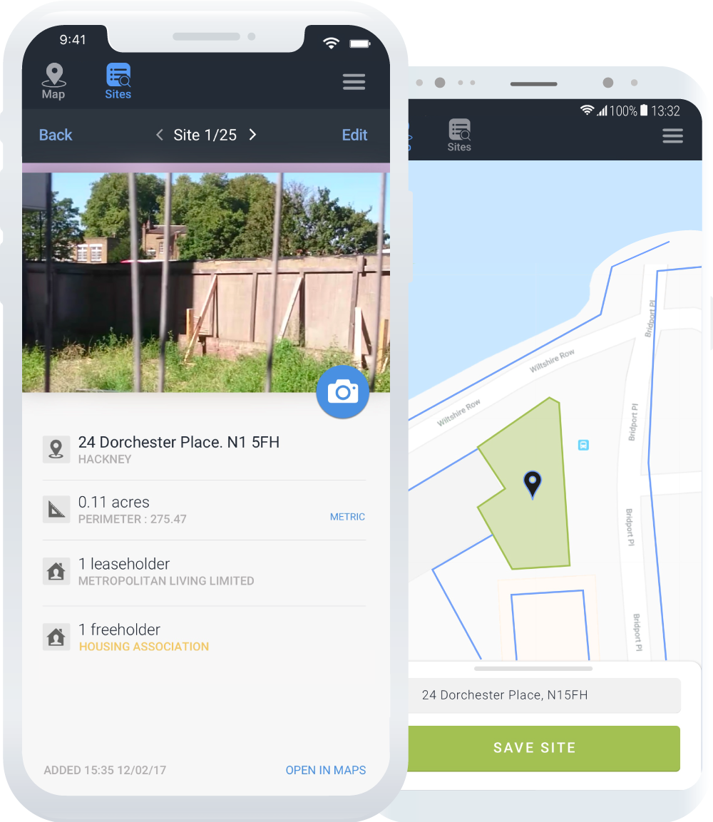
LandInsight GOSave and manage your development sites from your phone.
-
CommunityNetwork and collaborate on active opportunities, access valuable industry insights, and gain CPD accreditation through training tools all within a closed network of trusted professionals.
Learn about Community. -
LandFund BrokerageAccess the most competitive rates from a range of funding solutions to finance your development, fast. Learn about LandFund
-
LandFund's Appraisal Tool
Quickly appraise sites and generate data backed, lender-ready reports in an instant. Learn about LandFund
+£2,000 annually
-
Ownership LookupsDefined as clicking on the map to see the owner and contact address for the property.
300
-
Planning Application ViewsView and analyse planning application status and history on a property or site.
Unlimited
-
MasterMap™ ViewsThe most detailed and accurate mapping of Great Britain, a MasterMap View is a single load of the map.
100
-
Property InformationView the building dimensions, nearby building heights and flood risk associated with a property.
-
Lite Site InsightSummary of basic site information.
-
ComparablesProperty Sold Prices for the last five years.
-
Detailed Property SearchFind properties based on factors such as, floor area, rateable value, use class order, construction status and more.
-
Advanced Site InsightIn-depth site information compiled on a visual card. Move through ownership, planning, comparables layers and pin key information, add comments and attachments.
-
Comparables and £/sqftProperty Sold Prices and Price per square foot (£/sqft) for the last five years.
-
Planning SearchSearch and analyse planning applications made in areas or sites of interest.
-
Ownership SearchView properties owned by a commercial and corporate organisations. Filter by factors such as parcel size and tenure.
-
Leasehold dataView leaseholder info and search by leasehold start and end dates.
-
LandInsight GOSave and manage your development sites from your phone.
-
CommunityNetwork and collaborate on active opportunities, access valuable industry insights, and gain CPD accreditation through training tools all within a closed network of trusted professionals.
Learn about Community. -
LandFund BrokerageAccess the most competitive rates from a range of funding solutions to finance your development, fast. Learn about LandFund
-
LandFund's Appraisal Tool
Quickly appraise sites and generate data backed, lender-ready reports in an instant. Learn about LandFund
+£2,000 annually
-
Ownership LookupsDefined as clicking on the map to see the owner and contact address for the property.
Unlimited
-
Planning Application ViewsView and analyse planning application status and history on a property or site.
Unlimited
-
MasterMap™ ViewsThe most detailed and accurate mapping of Great Britain, a MasterMap View is a single load of the map.
100
-
Property InformationView the building dimensions, nearby building heights and flood risk associated with a property.
-
Lite Site InsightSummary of basic site information.
-
ComparablesProperty Sold Prices for the last five years.
-
Detailed Property SearchFind properties based on factors such as, floor area, rateable value, use class order, construction status and more.
-
Advanced Site InsightIn-depth site information compiled on a visual card. Move through ownership, planning, comparables layers and pin key information, add comments and attachments.
-
Comparables and £/sqftProperty Sold Prices and Price per square foot (£/sqft) for the last five years.
-
Planning SearchSearch and analyse planning applications made in areas or sites of interest.
-
Ownership SearchView properties owned by a commercial and corporate organisations. Filter by factors such as parcel size and tenure.
-
Leasehold dataView leaseholder info and search by leasehold start and end dates.
-
LandInsight GOSave and manage your development sites from your phone.
-
CommunityNetwork and collaborate on active opportunities, access valuable industry insights, and gain CPD accreditation through training tools all within a closed network of trusted professionals.
Learn about Community. -
LandFund BrokerageAccess the most competitive rates from a range of funding solutions to finance your development, fast. Learn about LandFund
-
LandFund's Appraisal Tool
Quickly appraise sites and generate data backed, lender-ready reports in an instant. Learn about LandFund
+£2,000 annually
All licenses are provided at business level and allow for multiple users per account


