
When you’re assessing a site, you’re not just looking at what’s on the land; you’re looking at what’s around it.
That includes the roads that connect it, the traffic that flows by, and the access that can make or break a new development.
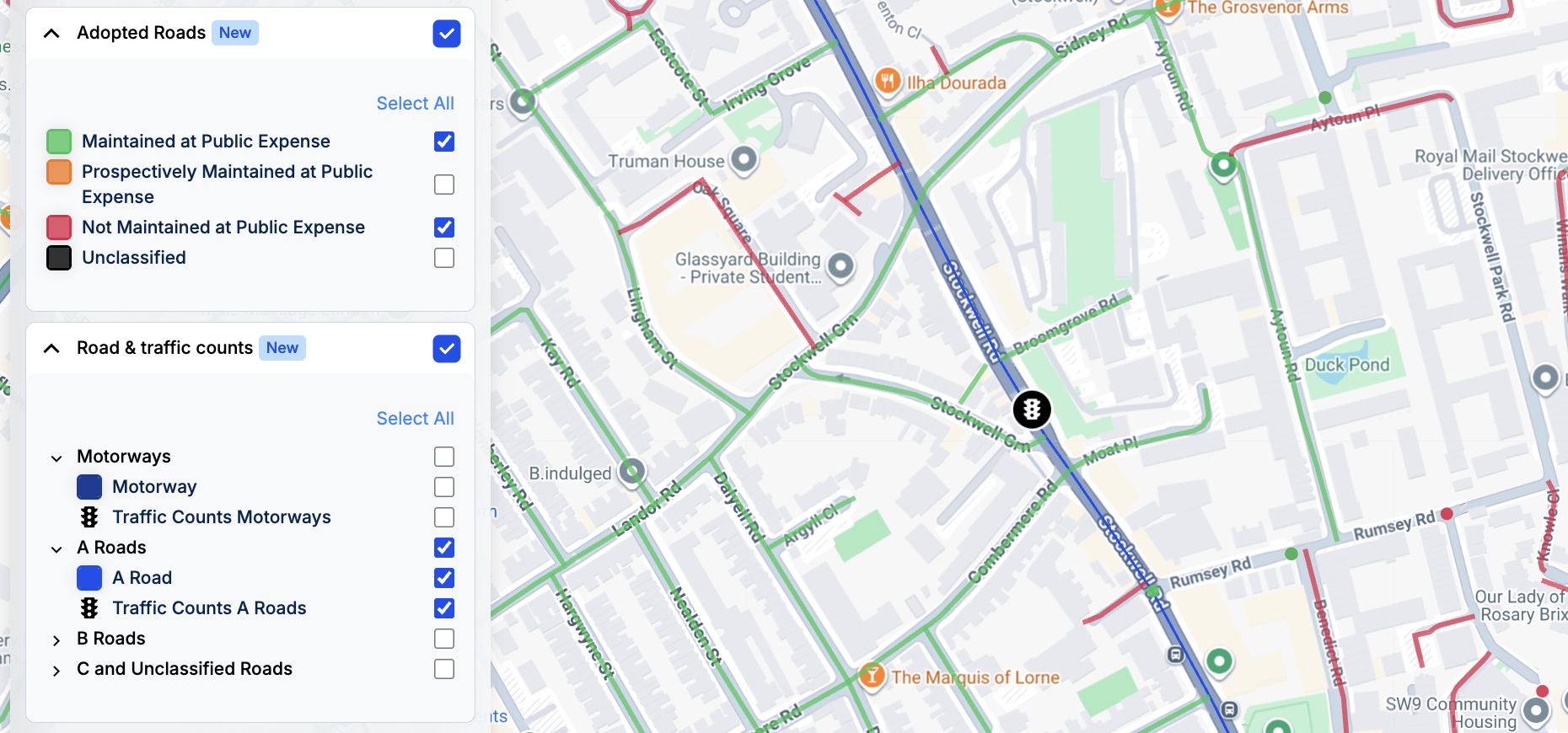
That’s why we’ve added two powerful new datasets to LandInsight, Traffic Counts & Volumes and Adopted Roads, giving you a more complete picture of road networks and the traffic that flows through them.
Together, they make it easier to evaluate access, risk, and demand - all direct within LandInsight.
Smarter Site Selection Starts with Better Road Intelligence
Whether you’re a residential developer assessing access for a new development, a commercial developer trying to gauge how busy local roads are for a new retail park, or an EV developer hunting for high-traffic locations, understanding the road network around your site is vital.
Now, you can get that clarity instantly:
- View road networks directly on the LandInsight map
- Access traffic counts (including historic data) from the Department for Transport
- Breakdown counts by vehicle type, giving a much more accurate picture
- Identify adopted and unadopted roads, helping you spot potential access issues early
No more jumping between platforms, downloading PDFs from different authorities, or second-guessing the status of local roads. It’s all there through the Road & Traffic Counts and Adopted Roads datasets.
Why This Matters
Because road context can make or break a deal.
- For EV developers: Identify high-potential charging locations near roads with specific traffic volumes, like heavy-goods routes or commuter corridors. Combine this with other filters (like petrol stations or retail sites) to pinpoint prime opportunities.
- For commercial developers: Understand where the busiest junctions are to find viable out-of-town retail or leisure sites.
- For residential developers: Get an early feel for whether local road upgrades might be needed before committing too much time or budget.
With Traffic Counts & Volumes, you can see where demand already exists. With Adopted Roads, you can see whether access is secure or if private ownership could present a hurdle.
It’s the kind of insight that helps you reduce risk, improve accuracy, and make faster, smarter development decisions.
Intelligent Data That Builds Confidence
These updates sit right at the heart of our LandIntelligence mission, giving you more context and clarity on every site, so you can move forward with confidence.
By combining datasets from the Department for Transport, Planning Authorities and Road Network Operators, we’re giving you the most up-to-date, in-depth view of road networks and traffic activity available, with adoption status refreshed every 30 days.
Because when it comes to land, confidence starts with understanding what’s around it.
Try It Today
If you’re an Unlimited customer, head to LandInsight now and turn on Roads and Traffic and AdoptedRoads to explore these new datasets.
If you’re not an Unlimited customer yet, click below to request a demo and see how LandInsight helps you make site assessments faster, smarter, and with more confidence.