

Local plans aren't written to be page-turners. Most run to several hundred pages, are split across multiple documents, and use terms like "strategic policy" and "development management" as though everyone was born knowing what they mean. Yet the local plan is the first thing a planning officer will check your site against, so understanding how to read one is one of the most useful skills a developer or land promoter can have.
The good news is that you don't have to read the whole thing cover to cover - you just need to know where to look, what order to look in, and which parts actually decide whether your site has a chance.
Key Highlights
- The local plan forms part of the statutory development plan, and planning applications must be decided in line with it unless other material considerations point elsewhere.
- Always check the plan's age and status first. An old plan, or one with a replacement on the way, changes how much weight its policies carry.
- Start with the policies map, then work through strategic policies, site allocations, and development management policies, in that order.
- The evidence base (particularly SHLAA or HELAA documents) often tells you more about a site's prospects than the policies do.
- The August 2026 NPPF has introduced national decision-making policies that take priority over local policies that clash with them, so a local policy's wording is no longer the whole story.
What Is a Local Plan?
A local plan is the document a local planning authority (LPA) prepares to set out how its area should develop over the coming years. It covers where new homes and employment land should go, what needs protecting, and the rules new development must follow.
What makes it so important is its legal status. The August 2026 National Planning Policy Framework reiterates that planning law requires applications for planning permission to be determined in accordance with the development plan, unless material considerations indicate otherwise. The local plan is usually the biggest part of that development plan, but not the only part. Depending on where your site is, you may also need to check:
- Neighbourhood plans, which are prepared by parish or town councils and neighbourhood forums, and can allocate sites and set local design requirements.
- Minerals and waste plans, usually prepared at county level.
- The London Plan, if you're working in the capital.
- Supplementary planning documents (being replaced by "supplementary plans" under the new system), which add detail to local plan policies on topics like design or parking.
Step 1: Check the Plan's Age and Status
Before you read a single policy, find out when the plan was adopted and whether a new one is being prepared. This will change how you read everything else.
Local plans are meant to be kept up to date, but many aren't. Under the new plan-making regulations, a local planning authority must begin preparation of a new local plan to replace the existing one within five years of adopting it. An old plan isn't automatically worthless, but its housing figures and some of its policies may carry less weight at appeal.
You should also check which system the council is working under. The new local plan system came into force in March 2026 with the Town and Country Planning (Local Planning) (England) Regulations 2026, replacing the 2012 plan-making regulations. Meanwhile, plans that had reached an advanced stage by early 2025 can still proceed under the old system if they are submitted by the end of 2026. That means many councils are currently rushing to get plans submitted before the cut-off, and it's worth knowing which camp your target authority falls into.
The council's website will usually have a "planning policy" or "local plan" page with the adopted plan, any emerging plan, and a local plan timetable. The government's Planning Data platform also collects local plan documents, boundaries, and timelines across England, though it's still a work in progress.
Step 2: Start With the Policies Maps
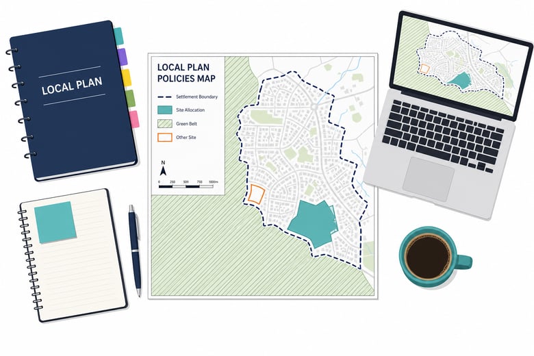
The policies map (sometimes called the proposals map) is the most useful single page in the whole plan. It shows, geographically, which policies apply where: settlement boundaries, Green Belt, site allocations, conservation areas, employment land, and local environmental designations.
Find your site on the map first. Is it inside or outside a settlement boundary? Is it allocated for something? Does it fall within a designation that restricts development? Within a couple of minutes, you'll know which policies you need to read in detail and which you can skip.
Step 3: Read the Strategic Policies
Strategic policies set the big picture. They usually cover:
- The spatial strategy, which explains where growth is being directed, often through a settlement hierarchy that ranks towns and villages by how much development each should take.
- The housing requirement, which tells you how many homes the council is planning for over the plan period.
- Employment land targets, retail hierarchies, and strategic infrastructure.
This section tells you how the council thinks about its area. If your site is on the edge of a village ranked near the bottom of the settlement hierarchy, you'll have a harder argument than one next to a town the plan identifies as a main focus for growth.
Pay particular attention to the housing requirement. If it's significantly lower than the council's current local housing need figure, or the council can't show enough deliverable land to meet it, that can help evidence an unmet housing need. Under the NPPF 2026, that's one of the routes to approval for sites outside settlement boundaries.
Step 4: Find the Site Allocations
Site allocations are specific pieces of land the council has earmarked for development, usually with a policy for each site setting out what's expected: the number of homes, access requirements, affordable housing, and any infrastructure contributions.
If your site is allocated, read its policy closely, because it effectively sets the terms of any future planning application. If it isn't, look at the allocated sites nearby. They show you what the council considered suitable, and if allocations aren't coming forward as planned, that's useful evidence too.
Step 5: Work Through the Development Management Policies
Development management policies are the detailed rules applied to individual planning applications: design, parking, affordable housing percentages, space standards, biodiversity, and so on. Historically, this is where local plans got long, repetitive, and slightly different from one council to the next.
This is also where the August 2026 NPPF has changed things most. The revised framework introduced national decision-making policies, and plan-makers are instructed not to include local policies that duplicate, substantively restate, or are inconsistent with them. For existing plans, development plan policies found to be "materially inconsistent" with the new national policies must be given reduced weight by decision-makers.
In practice, that means you can't just read a local development management policy and take it at face value anymore. You need to check it against the relevant national policy, too.
Step 6: Dig Into the Evidence Base
The evidence base is the collection of technical studies that sit behind the local plan. It isn't policy, but it's often where the most useful intelligence is hiding. Key documents include:
- The SHLAA or HELAA, which assesses land put forward for development and records whether the council considered each site suitable, available, and achievable.
- The Authority Monitoring Report, which tracks how the plan is performing, including housing completions.
- The five-year housing land supply statement, which shows whether the council can demonstrate enough deliverable housing land. Government guidance says councils can demonstrate their supply using evidence such as a SHLAA, HELAA, or Authority Monitoring Report.
- Green Belt reviews, flood risk assessments, and landscape studies, which explain why certain areas were ruled in or out.
If your site was assessed in a SHLAA and rejected, the reasons will be written down. Sometimes those reasons are out of date, such as an access issue that's since been solved or a landowner who's now willing to sell. That's where opportunities are found.
Step 7: Check the Emerging Plan and Consultation Timetable
If the council is preparing a new local plan, the emerging version matters as much as the adopted one. Emerging policies gain weight as the plan progresses, and early stages are your chance to promote a site.
Under the 30-month process, plan-making includes a period of early engagement, followed by two rounds of public consultation and three gateway assessments, with the second and third led by the Planning Inspectorate. Many councils also run a "call for sites" at the start of the process. If you have land to promote, missing that window can mean waiting years for the next one.
Common Mistakes to Avoid
-
Reading the policy but not the supporting text. The paragraphs beneath each policy explain how it's meant to be applied, and officers use them.
-
Forgetting about other parts of the development plan. A site that looks fine against the local plan can still be caught by a neighbourhood plan policy.
-
Treating the policies map as the final word. Maps are only as current as the plan they come from. Check for newer designations, such as conservation area extensions or Article 4 Directions.
-
Ignoring national policy. Since August 2026, national decision-making policies can outweigh local wording that clashes with them.
How LandInsight Makes Local Plans Easier to Read
Reading one local plan properly takes time. Reading several to compare opportunities across a region can take weeks.
LandInsight brings adopted local plan data onto a single map, including Green Belt areas, settlement boundaries, housing allocations, and conservation areas, alongside local evidence such as SHLAAs and SHELAAs. You can see how a site sits against local policy in seconds, then use that time to dig into the detail that matters.

FAQs
How long does a local plan last?
Most local plans cover a period of around 15 years, but councils must start preparing a replacement within five years of adoption.
What happens if a local plan is out of date?
The plan still forms part of the development plan, but some policies, particularly those on housing numbers, may carry less weight. National policy then plays a bigger role in decisions.
Where can I find my council's local plan?
Check the planning policy section of the council's website. The government's Planning Data platform is also building a national record of local plans.
What is the difference between a local plan and a neighbourhood plan?
The council prepares a local plan for its whole area. A neighbourhood plan is prepared by a parish council or neighbourhood forum for a smaller area, and sits alongside the local plan as part of the development plan.

Related Reading
- The National Planning Policy Framework (NPPF), Explained
- The NPPF Playbook: Navigating Policy Hierarchy with Decision-Making Policies and Local Plans
- The New Planning Landscape: How the 2026 NPPF Unlocks Development Opportunity
- How to Use SHLAA to Find Development Sites
- What Is Grey Belt Land? The Definitive Developer's Guide