
Between tight housing targets, limited available land, and strict planning rules, developers often struggle to source parcels that are both viable and low-risk.
In 2024, the Labour Party set a target to build 1.5 million homes over the next five years, which equates to about 300,000 houses annually.* This puts even more pressure on developers to find the right opportunities without too much delay.
Grey belt areas present an interesting opportunity for developers. Located within the Green Belt, these areas should be released from the Green Belt and promoted for development because they only contribute weakly to Green Belt purposes.
In this guide, you’ll learn what grey belt land is, its key characteristics, and its implications for development projects.
We’ll also explain how to identify these sites and how certain tools can give you a competitive edge in finding, assessing, and securing grey belt opportunities.
Key Highlights
- Grey belt land is located within the Green Belt land and offers development potential because it can meet the new policy tests in the NPPF and PPG without undermining three of the five protective goals of Green Belt land.
- These are typically previously protected sites that do little to alleviate urban sprawl, prevent neighbouring towns merging, or protect the character of historic settlements.
- Grey belt sites are more likely to gain planning support when they’re sustainably located. This could mean, among other things, that they’re well connected and avoid high-value farmland.
- It’s possible to win strong public and political backing for redeveloping underused Green Belt land, especially when projects deliver affordable housing, green enhancements like parks, and improvements to local infrastructure.
- LandTech’s Grey Belt Favourability rating allows developers to get an at-a-glance view of the Green Belt by providing an analysis of policy criteria, sustainability data, and local needs to help developers get ahead of the competition.
Understanding the Grey Belt
You need to understand the grey belt if you want to stay ahead in today’s planning game. With councils balancing housing targets and green space protection, knowing what actually qualifies as grey belt land really can help you spot opportunities before everyone else does.
What is grey belt land?
Grey belt land is a relatively new planning concept designed to unlock development opportunities within the Green Belt without compromising its protective purposes.
Harry Quartermain, Head of Research & Insights at LandTech, points out that ‘not all Green Belt land is actually green.’
Some Green Belt areas include sites like car parks, sewage works, and quarries, ‘which are issued the same level of protection as the agricultural fields around towns that are protected from housing development’.
So while grey belt land technically sits within the Green Belt, it doesn’t strongly contribute to its key objectives, such as preventing urban sprawl, stopping neighbouring towns from merging, or preserving the character of historic towns.
Examples of grey belt sites include disused airfields and low-quality agricultural land. These are usually parcels that don’t strongly contribute to core Green Belt functions, meaning they can accommodate development without causing much damage.
According to the National Planning Policy Framework (NPPF) and Planning Practice Guide (PPG), grey belt assessment focuses on three key Green Belt purposes:
- a) checking unrestricted sprawl
- b) preventing neighbouring towns from merging
- d) preserving the setting and character of historic towns
Grey belt sites also need to meet several additional criteria:
- There must be a demonstrable need for the development, such as a local housing shortfall or unmet delivery targets.
- The site should be in a ‘sustainable location’, while the matters that constitute a ‘sustainable location’ are not laid out in the policy, this could mean good access to public transport, walking, and cycling, and could mean avoiding building on the best and most versatile farmland.
- For housing, applicants are expected to meet the ‘Golden Rules’ set out in the NPPF, which include delivering extra affordable housing, improving local infrastructure, and enhancing green spaces.
Pro tip: Finding grey belt sites early means you can focus on areas with the best potential rather than spending your time on locations that will face planning resistance. With well-chosen sites, you are less likely to need to prove special circumstances to justify why development should be allowed.
Grey belt land plays a strategic role in UK planning, and it’s a practical tool for making smart, policy-aligned decisions. It can help developers:
- Work towards meeting housing targets: Grey belt sites help local authorities and developers tackle housing shortages in the UK. By focusing on these parcels, you can deliver new homes in currently underutilised areas.
- Distinguish from brownfield land: Unlike brownfield sites, which are previously developed urban areas, the grey belt includes Green Belt parcels and other land that doesn’t strongly serve core Green Belt purposes. This opens up a wider range of opportunities for developers.
- Strategically release low-value Green Belt sites: Grey belt sites encompass land that’s less critical to protecting the Green Belt. This enables developers to unlock development potential while preserving the countryside.
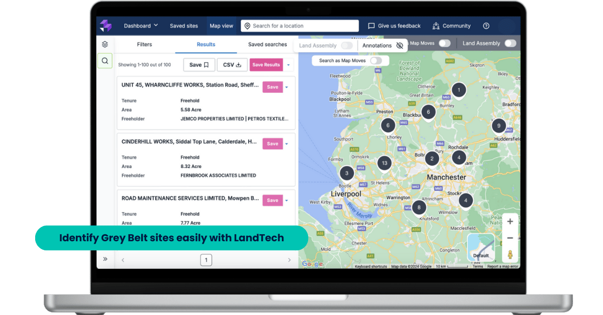
Pro tip: A tool like LandInsight helps you quickly find grey belt land that fits these criteria to give you a head start in early-stage assessments.
What Are the Characteristics of Grey Belt Land?
The hidden value of the grey belt lies in spotting sites that are overlooked but still offer strong development potential.
Understanding the key characteristics of these sites can help you quickly evaluate which parcels are worth investing in to save you time and give you a strategic edge in a competitive market.
It provides a weak contribution to grey belt goals
Another key characteristic of grey belt land is that it contributes only weakly to core Green Belt purposes. In other words, its presence doesn’t:
- alleviate urban sprawl
- prevent neighbouring towns merging
- protect the character of historic settlements
For example, a small parcel of land that’s nestled between two suburban areas, but is outside of any defined settlement boundary might not play a meaningful role in preventing sprawl.
Similarly, land that sits away from historic town centres or listed buildings contributes little to preserving character and heritage.
On the other hand, parcels that are central to a town’s identity or form a buffer between neighbouring towns wouldn’t fall into the grey belt category.
Its well-located and sustainable
Sustainability and location are central to the value of grey belt sites. A site might be previously undeveloped and low in contribution to Green Belt goals, but if it’s poorly connected, bakes in further car dependancy, or sits on prime farmland, it won’t be a good development opportunity.
To meet the ‘sustainable location’ criterion for Grey belt land, a site will typically score well on connectivity, which means it’s easily accessible by public transport, walking, or cycling.
For instance, a site that’s just a short walk from a train station with nearby schools, shops, and community amenities is far more attractive for a housing development than a remote plot with limited access.
How Do You Identify Grey Belt Land?
To identify grey belt sites, you first have to understand the five Green Belt purposes as set out in the NPPF and PPG. These are to:
- check the unrestricted sprawl of large, built-up areas
- prevent neighbouring towns from merging into one another
- assist in safeguarding the countryside from encroachment
- preserve the setting and special character of historic towns
- assist in urban regeneration by encouraging the recycling of derelict and other urban land
As we mentioned above, only purposes a, b, and d are specifically called out within the grey belt policy. However, grey belt sites are also required to demonstrate that they do not undermine the function of the remaining Green Belt.
Some Inspectors have used this provision to make reference to other Green Belt purposes not specifically called up in this policy.
That means if a site doesn’t strongly help stop sprawl, prevent town merging, or protect historic town character, it could fall into the grey belt category, as long as it also meets other key criteria like sustainability and a demonstrable development need.

Identifying grey belt land is about bringing together policy know-how with practical, data-led insights.
That’s where LandTech comes into play. Our platform, LandInsight, lets developers layer data to assess sites against these Green Belt purposes.
- 1. You can map settlement boundaries, physical barriers, and buffers between towns to see if the site scores low for purposes a and b.
- 2. Heritage and conservation datasets help you check purpose d.
- 3. Add in transport and land use data, and you can get a quick sense of whether a parcel might be suitable for development, all without leaving your desk.
Of course, no tool replaces human judgement. Questions like meeting the NPPF’s “Golden Rules” or checking site viability still need expert eyes. But LandTech gives you a head start by:
- highlighting sites that are less likely to be considered inappropriate
- helping you to focus on parcels with real potential
That means you can move faster when it comes to finding the right sites and concentrate on land that could make an impact on your development pipeline.
Why Grey Belt Spaces Present An Interesting Opportunity for Land Developers
Spotting grey belt parcels early can give you a serious advantage in a competitive space. Multiple grey belt sites across a borough can add up to a huge impact, both in terms of your portfolio growth and potential ROI.
Instead of chasing the same high-demand urban or brownfield sites that every other developer is fighting over, grey belt land gives you access to areas few others are looking at.
It’s also a chance to think and plan strategically. By understanding where grey belt land sits in relation to settlements, transport links, and local amenities, you can create a pipeline of opportunities that is both sustainable and high-value.
Discover the untapped potential of grey belt land. This guide explores fresh, practical insights for policymakers and developers seeking to build the right homes in the right places.

Find Grey Belt Land and Gain a Competitive Edge with LandTech
As you now know, grey belt land presents an untapped opportunity, but finding the right sites can be tricky without the proper tools.
LandTech combines planning data, ownership records, transport and heritage information, and agricultural classifications to help you quickly identify parcels that are the most likely to qualify as grey belt, and give you a head start over other developers.
Early-stage evaluations against Green Belt purposes a, b, and d, along with sustainability indicators and local need data, let you prioritise the parcels with the highest likelihood of successful development.
And by centralising all this information, LandInsight makes decision-making far simpler, which reduces the risk of missed opportunities.
LandTech helps you move faster and build a strong pipeline of grey belt opportunities. You get the insights you need to identify, assess, and secure sites that deliver impact, all while navigating the complexities of Green Belt policy with ease.
Find, assess, and secure grey belt sites faster than anyone else. Discover how LandTech can give you a competitive edge in sourcing promising sites with in-depth data and automated alerts.

*Planning overhaul to reach 1.5 million new homes, GOV.UK
FAQs About Grey Belt Land
What is Green Belt land?
Green Belt land is designated to prevent urban sprawl, protect the ‘openness’ of the countryside, preserve the character of historic towns, and encourage the recycling of underused brownfield land in urban centres.
Development on these sites is strictly controlled by authorities, with most new building considered inappropriate unless there are very special circumstances that can be proven.
Can you put a log cabin on Green Belt land?
Permanent structures like log cabins aren’t typically allowed on Green Belt land. Temporary or agricultural buildings may be permitted with planning permission, but residential use is usually restricted unless there are very special circumstances.
What is the grey belt in politics?
In UK politics, grey belt refers to land within the Green Belt that could be released for new homes without undermining the core purposes of the remaining Green Belt.
It’s a term used to highlight sites like old car parks, empty plots or storage yards that offer development potential without harming the countryside.