In the world of property, having access to detailed and accurate property information is crucial for making informed decisions - especially when you’re at the beginning of your site sourcing process.
Having a clear overview of not only the property you’re interested in, but also those in the near vicinity, can expedite both the site sourcing and assessment process. In this article, we’ll take a look at LandInsight’s Property Information layer, a comprehensive view for evaluating a potential development site and understanding the broader context of the surrounding area to help you uncover both challenges and opportunities that lie within.
What is the Property Information layer?
The data within the Property Information layer aids in assessing feasibility, understanding potential constraints, and identifying unique opportunities that a property might present.
Whether it's evaluating the redevelopment potential of a site through change of use class or assessing a derelict building on a site you’re considering, the Property Information layer provides a solid foundation for precise research and informed decision-making.

What data is in the Property Information layer?
LandInsight’s Property Information layer is rich with data essential for property developers, sourced from reliable and authoritative databases. This view includes:
- Use Class, Type of Property, and Status: Information retrieved from OS AddressBase Plus, offering insights into the current use class, the property type, VOA state of use, and its occupancy status. This dataset is refreshed every 4-6 weeks to ensure up-to-date information.
- Building Dimensions: Pulled from the OS Master Map, these details allow developers to understand the size and footprint of buildings on a potential development site, crucial for planning and design considerations.
- Listed Building Status: Sourced from Historic England, Historic Environment Scotland, and Cadw in Wales, this information identifies whether a property is listed, indicating special architectural or historic interest. Such status can significantly impact the potential for development or renovation, as well as the buildings nearby.
Each of these data points plays a critical role in the early stages of property development, from site selection to initial project scoping. By providing a clear, comprehensive view of key property characteristics and constraints, the Property Information view enables users to navigate the complexities of the development landscape with confidence.
Best practices for maximising the Property Information layer
From our in-depth Property Information Search to the Site Sourcing Tool and Sites Pipeline, there are a number of ways to maximise the use of the Property Information view in LandInsight:
Property Information Search
There are two ways to view the Property Information data within LandInsight. The first is simply reviewing the Property Information layer, where you’ll see property boundaries. When clicking on any parcel, you’ll receive the address, type of property, use class, its current state, building dimensions, nearby building heights and any constraints that may impact the location.
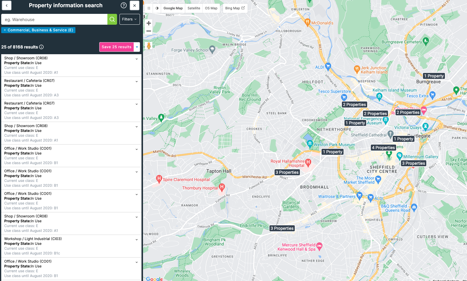
For a more detailed search option, use the Property Information Search, which allows users to search for properties using keywords like “warehouse”, “vacant” or “Use Class C3”, as well as the ability to filter for total floor area (in square metres and hectares) and rateable values. This search will populate a list of results both in a list format on overlaid your current map location.
Site Sourcing Tool
Within the Site Sourcing Tool, you can get even more granular. Use the filters in this feature to refine your search to find properties with a specified Use Class, parcel size, ownership type, tenure and more. Once you’ve run your search, all properties that meet your criteria will be shown overlaid on your map.
Managing your sites effectively
Regardless of which feature you use to find the right property that fits your criteria, you’ll want to ensure you’re saving potentially valuable opportunities into your Sites Pipeline. Once you’ve found the right opportunity, simply click the parcel and save your site to your pipeline. You can move your sites throughout your customised stages to ensure you never lose track of your opportunities.
Here’s our top 10 tips on getting the most out of your sites pipeline.
Ready to get started?
Whether you’re assessing the potential of a new site or planning the future of an existing property, the Property Information layer is an indispensable tool in your development arsenal. And the best part? There are even more layers to explore to help you get everything you need to turn off-market opportunities into successful projects.
Check out our free eBook, The Seven Building Blocks to Success: A Property Developer’s Guide to LandInsight, to take a deeper look at all the data available in LandInsight and how it can help you streamline your site sourcing.

