Uncover your next opportunity with the Planning Applications layer

Picture of Andrea Duke

Andrea Duke
March 12, 2024
Read time: minute(s)

Navigating the planning system is just one hurdle property developers face when it comes to sourcing and assessing off-market opportunities. And while finding the relevant information you need can seem like a challenge, it can also be a massive opportunity to learn more about the area you intend to review for viable opportunities. 


Whether you’re looking for residential or commercial opportunities, understanding what the local area needs and what has (or hasn’t) been successful in overcoming planning permission is a crucial step to truly understanding if the area is the right place for your plans. 


LandInsight's Planning Applications layer serves as a pivotal tool in this strategic approach, offering a comprehensive overview of different types of planning applications. Below, we’ll review what the Planning Application layer is, what data you’ll have access to, and how to best utilise this layer for success.


What is the Planning Applications layer?

The Planning Applications data layer is a feature designed to streamline the identification and analysis of planning applications across England, Wales, and Scotland. This layer aggregates data on planning applications, into a single, easily navigable view within LandInsight. 


The Planning Applications layer is invaluable for property developers, offering insights that facilitate the early identification of potential development opportunities and the assessment of local market trends. It also serves as a critical component in the decision-making process, enabling you to strategically plan your next move.

landinsight-planning-applications-layer

What data is in the Planning Applications layer?

Now that we have the basics of the Planning Applications layer covered, let’s take a better look at the data available in this layer, where the data comes from, and how often it's updated.

Planning application and boundary information

This view is enriched with detailed application highlights such as classification, submission date, decision, and more, all accessible within a click. This wealth of information is sourced directly from Local Planning Authorities (LPAs) and is refreshed every 24 hours, ensuring that users have the most current data at their fingertips.

Planning appeals

Additionally, the layer provides insights into planning appeals for applications that have been refused. This includes a brief overview of the appeal, encompassing the appeal type, reason, decision, and a direct link for further information. This appeal data is meticulously gathered from the Planning Inspectorate Appeals Database and is updated every three months.

Significant constraints

Understanding the significant constraints of an area is also crucial when reviewing planning applications and their decisions. This view offers comprehensive information on various constraints, including protected areas, green belt land, flood zones, and nutrient neutrality, among others. Although the frequency of updates for constraint data varies, it plays a pivotal role in assessing how these factors could influence the outcomes of existing or future planning applications.

You can learn more about the source of this data and how often it is updated here.

Best practices for maximising the Planning Applications layer

To fully harness the potential of the Planning Applications layer, integration into the initial phases of your research and decision making is crucial. From filtering to match your specific criteria and streamlining your project management with the sites pipeline feature to setting up proactive planning alerts, using these features can help you make the most of your time when researching and conducting due diligence. 

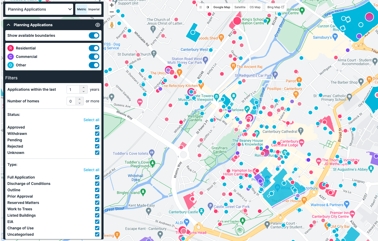
Filter to find what you need

LandInsight's Planning Applications data layer allows you to filter and search through planning applications with a custom level of detail and specificity.

These filters include:

  • Application Submission Date
  • Number of Homes
  • Application Status
  • Type of Planning Application


Planning applications search

Alternatively, you can use the Planning Applications Search function to search for planning applications using keyword search to include or exclude certain terms like “use class E”. You can also use this search to narrow down the date planning applications were received. Results will be compiled in a list format, downloadable as CSV, and shown overlaid with your current location on the map. 

Proactive planning alerts

Finally, one of the most exciting features of this layer - planning alerts. Within Planning Applications Search, you can set automated alerts, delivered to you via email or through the app. You can customise these alerts by adding criteria such as use class, number of dwellings, approval status, rejection status, and more.

These proactive planning alerts will not only help you beat the competition, but you’ll also save countless hours of manual research, allowing you to spend more time on informed decision making on your next opportunity. 


Ready to uncover your next opportunity?

The Planning Applications layer is designed to be an indispensable resource for professionals, combining depth of data with navigational simplicity. This layer provides not only a single view that makes it possible to identify potential development sites, but also provides a platform for comprehensive market analysis, ensuring that users can make informed decisions with greater confidence and strategic insight.

The Planning Applications layer is just one of many views developers can use to streamlining their site sourcing. Check out our free eBook, The Seven Building Blocks to Success: A Property Developer's Guide to LandInsight, to learn more about LandInsight's other data layers and how they can help you streamline your site sourcing. 


Download Now